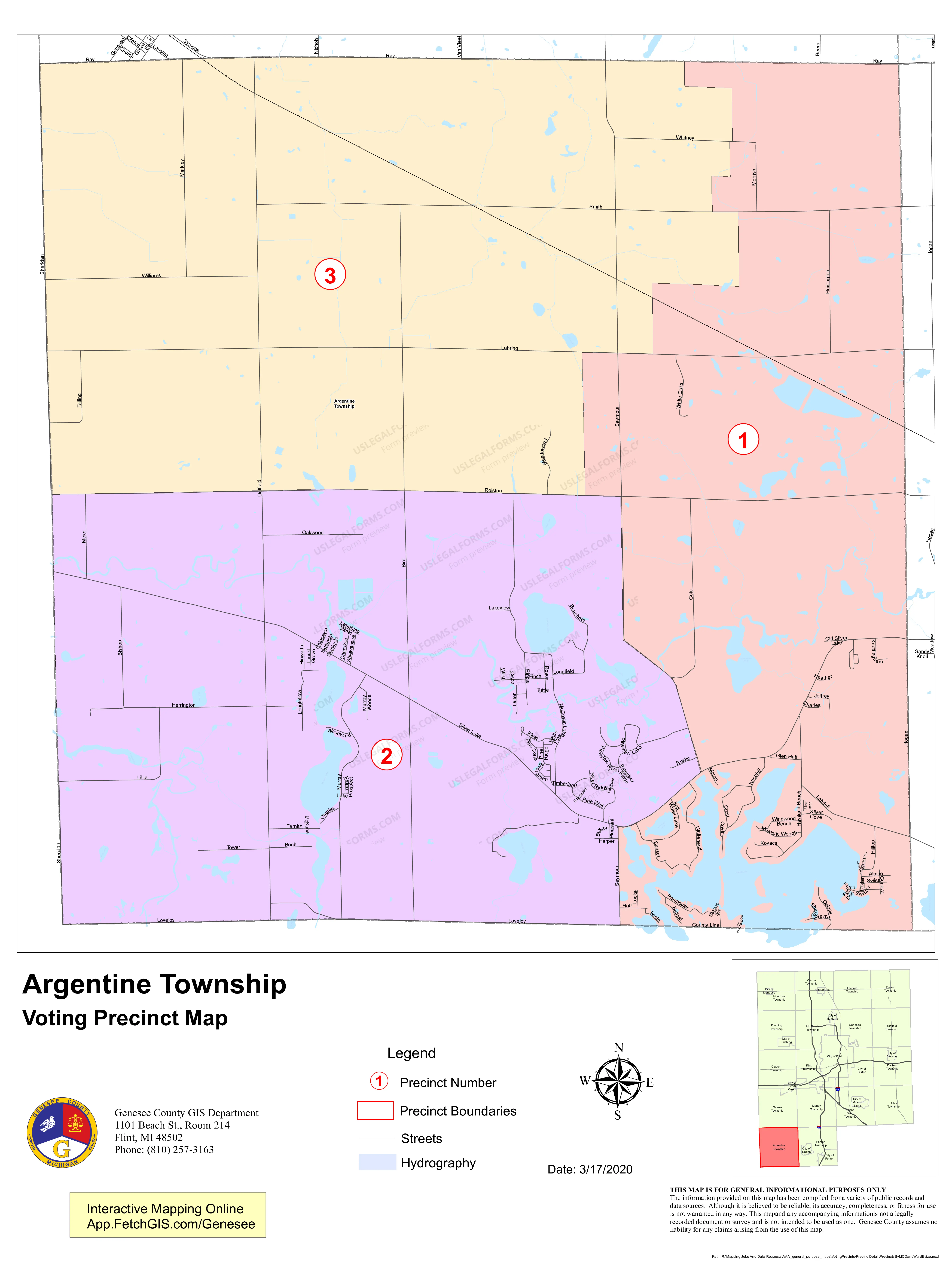
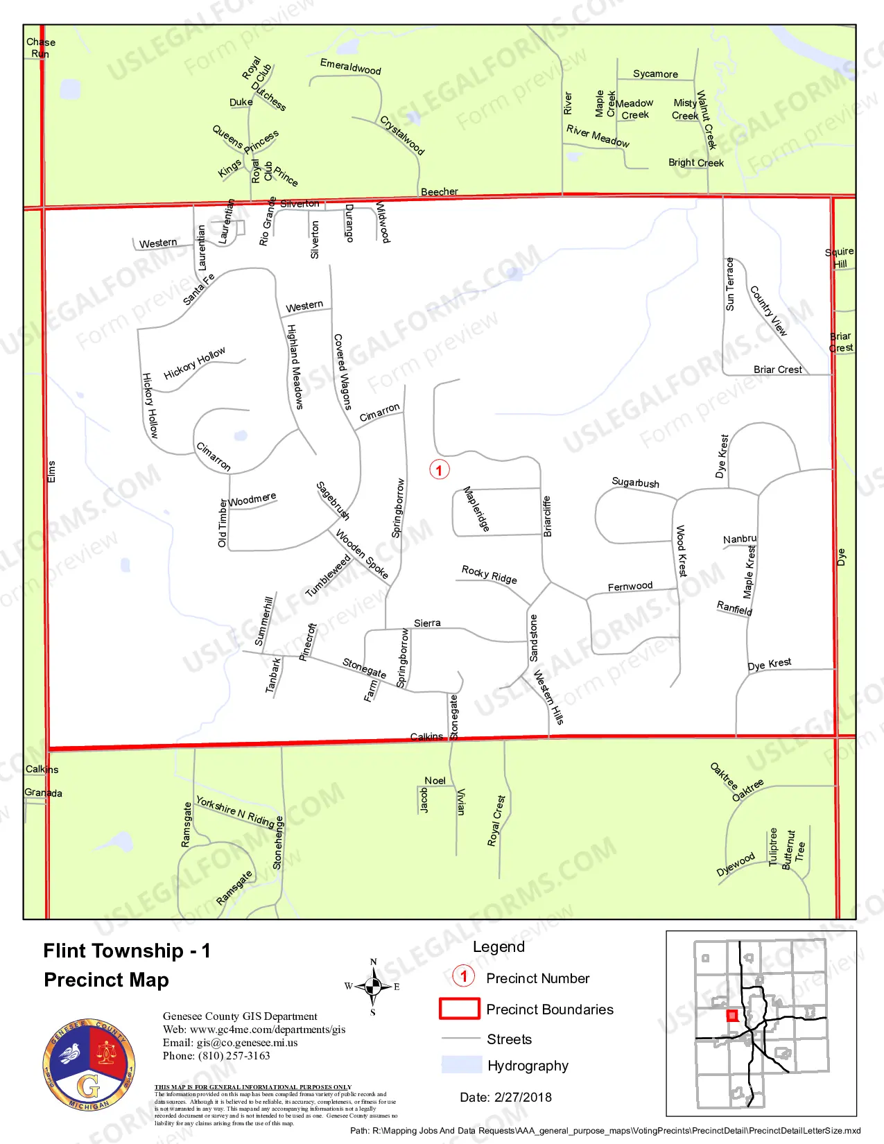
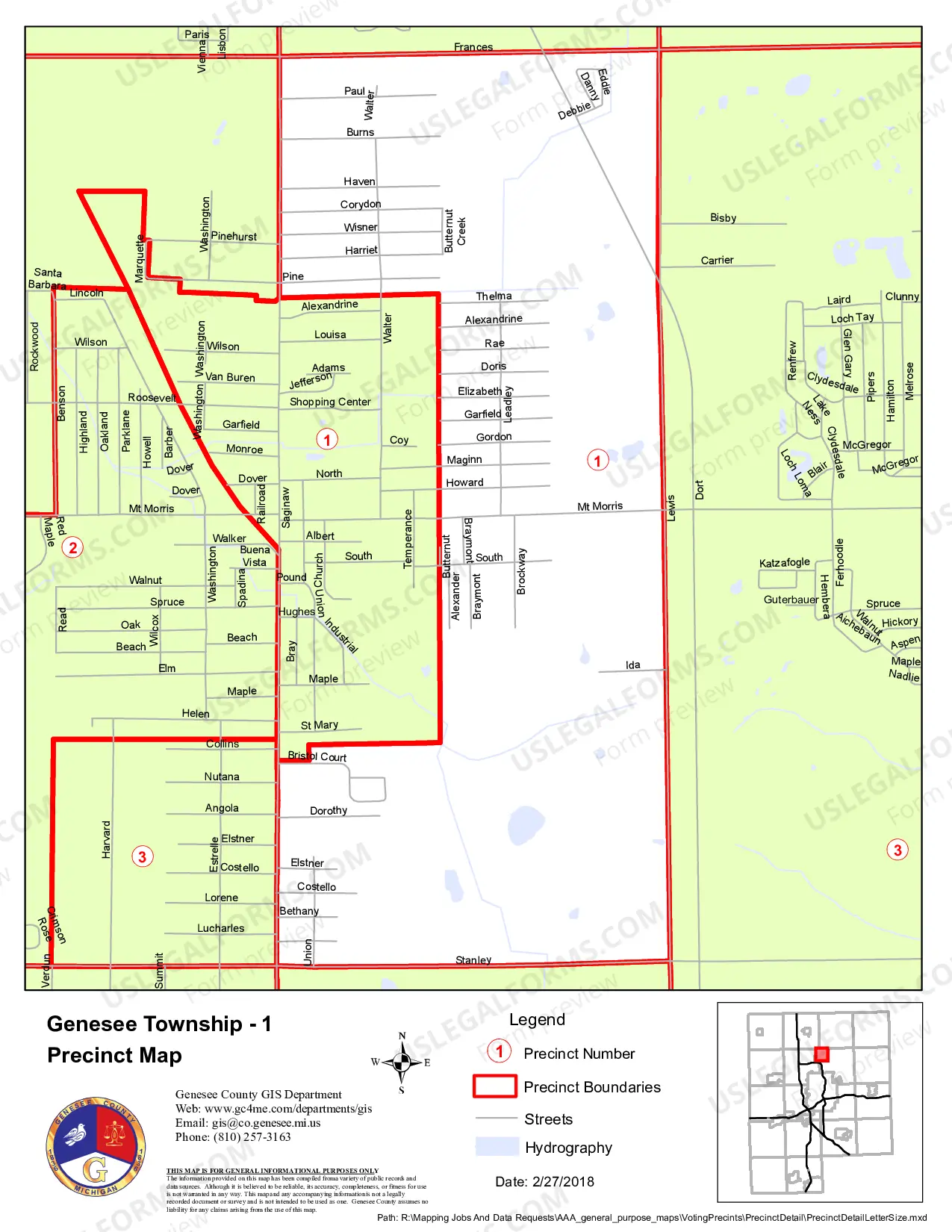
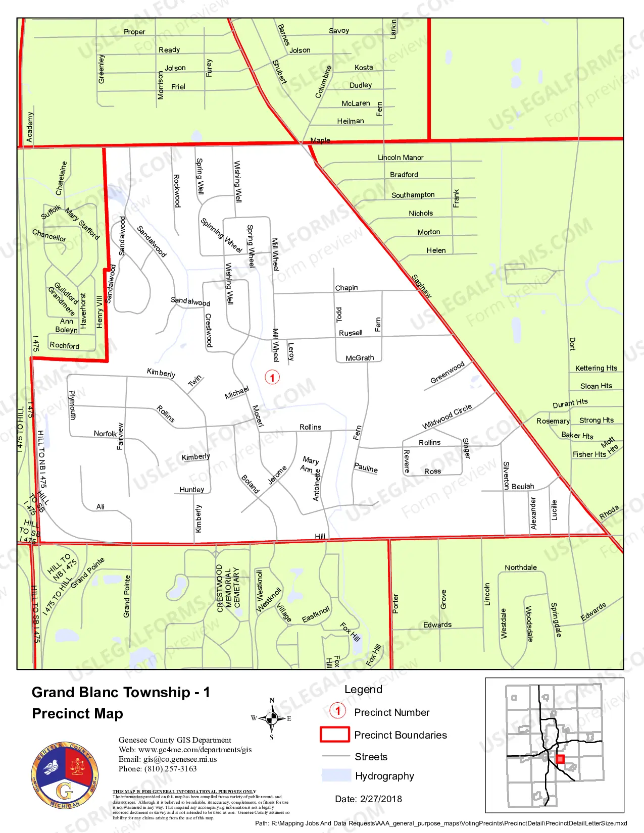
Michigan Genesee County Political District Map Book (updated 2017) is a collection of detailed maps that provide political district boundaries for Genesee County, Michigan. The book includes maps of all the County Commissioner Districts, City Council Districts, School Districts, and Congressional Districts. It also includes a map of the City of Flint and other maps for major townships and villages within Genesee County. The maps are updated to reflect the 2017 redistricting changes. The maps are printed in full color and are easy to read. The map book is an essential resource for anyone interested in understanding the political districts within Genesee County.
Michigan Genesee County Political District Map Book (updated 2017)
Instant download
This website is not affiliated with any governmental entity
Public form
Description
Genesee County Political District Map Book (updated 2017)
Free preview
")
")
")
")
")
")
")
")
")
")
")
How to fill out Michigan Genesee County Political District Map Book (updated 2017)?
If you’re looking for a method to suitably finalize the Michigan Genesee County Political District Map Book (revised 2017) without employing an attorney, then you’ve come to the perfect place.
US Legal Forms has established itself as the most comprehensive and dependable repository of official templates for every personal and business situation. Each document you discover on our online platform is crafted in alignment with federal and state regulations, so you can rest assured that your files are properly organized.
Another great aspect of US Legal Forms is that you never lose the documentation you acquired - you can access any of your downloaded forms in the My documents section of your profile whenever necessary.
- Ensure the document displayed on the page aligns with your legal circumstances and state regulations by reviewing its textual description or browsing through the Preview mode.
- Enter the form title in the Search tab at the top of the page and select your state from the dropdown menu to locate an alternative template if any discrepancies arise.
- Repeat the content verification and click Buy now once you are certain that the paperwork meets all requirements.
- Log in to your account and click Download. Create an account with the service and choose the subscription plan if you haven’t done so already.
- Utilize your credit card or the PayPal option to purchase your US Legal Forms subscription. The document will be available for download immediately.
- Select the format you prefer for your Michigan Genesee County Political District Map Book (revised 2017) and download it by clicking the relevant button.
- Upload your template to an online editor for quick completion and signature, or print it out to prepare your physical copy manually.
Form popularity
FAQ
Is located in the 13th Congressional district of Michigan.
Michigan's 9th congressional district is a United States congressional district located in The Thumb and northern portions of Metro Detroit of the State of Michigan. Counties either wholly or partially located within the district include: Huron, Tuscola, Sanilac, Lapeer, St. Clair, Macomb and Oakland.
Michigan's 17th congressional district is an obsolete United States congressional district in Michigan. The first Representative to Congress elected from the 17th district, George Anthony Dondero, took office in 1933, after reapportionment due to the 1930 census. The district was dissolved following the 1990 census.
District 1 is a legislative district within the Michigan House of Representatives located in the northeastern corner of Wayne County, Michigan, including the Upper East Side of Detroit and the Cities of Harper Woods, Grosse Pointe Woods, and Grosse Pointe Shores.
Abstract: These data depict the 117th Congressional Districts and their representatives for the United States. Congressional districts are the 435 areas from which members are elected to the U.S. House of Representatives.
Michigan is divided into 13 congressional districts, each represented by a member of the United States House of Representatives.
Area: Genesee County has a total area of 648 square miles (1682 sq km). Approximately 638 sq miles (1652 sq km) of it is land and 10 sq miles (26 sq km) of it is water.