Boundary Line Agreement and Deed Between Adjacent Land Owners
What this document covers
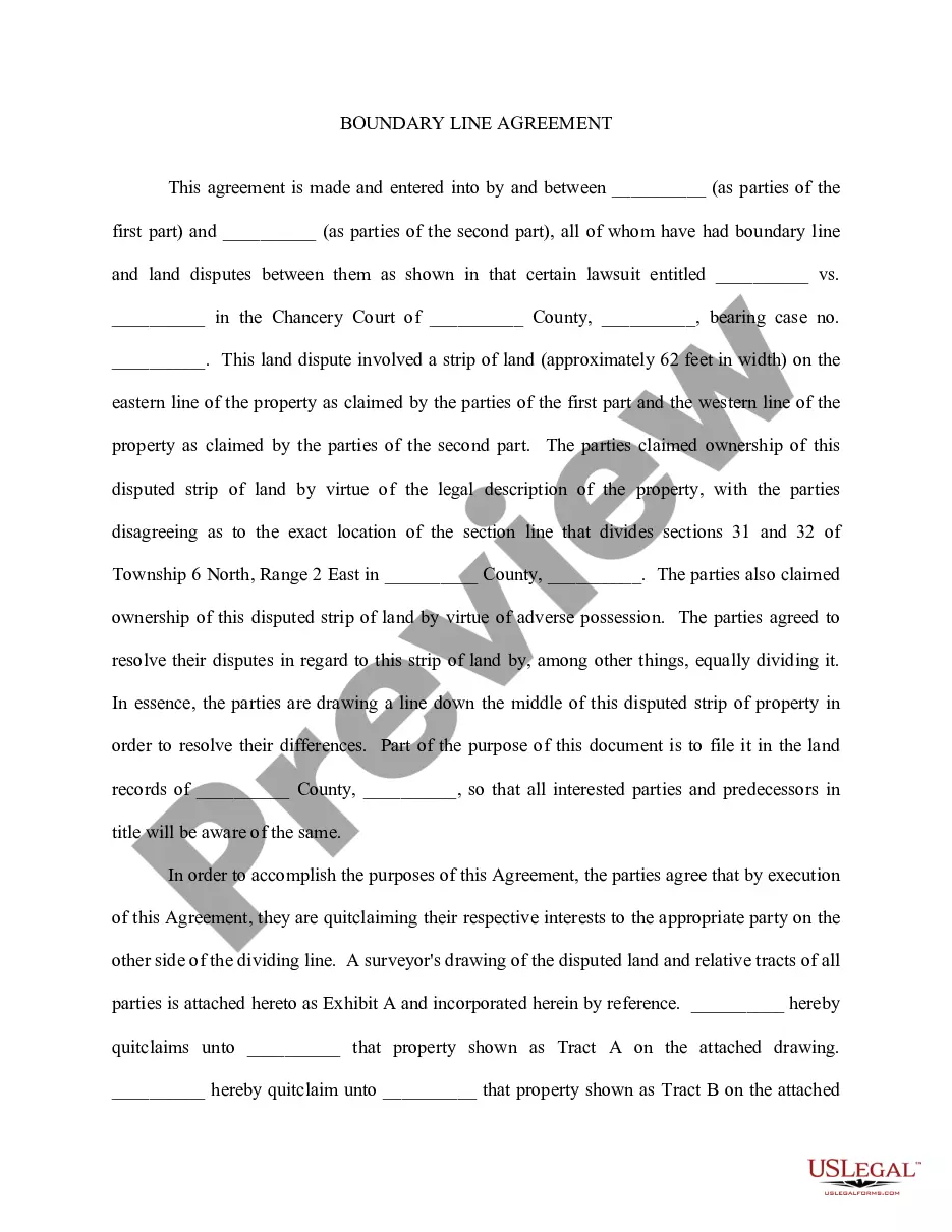
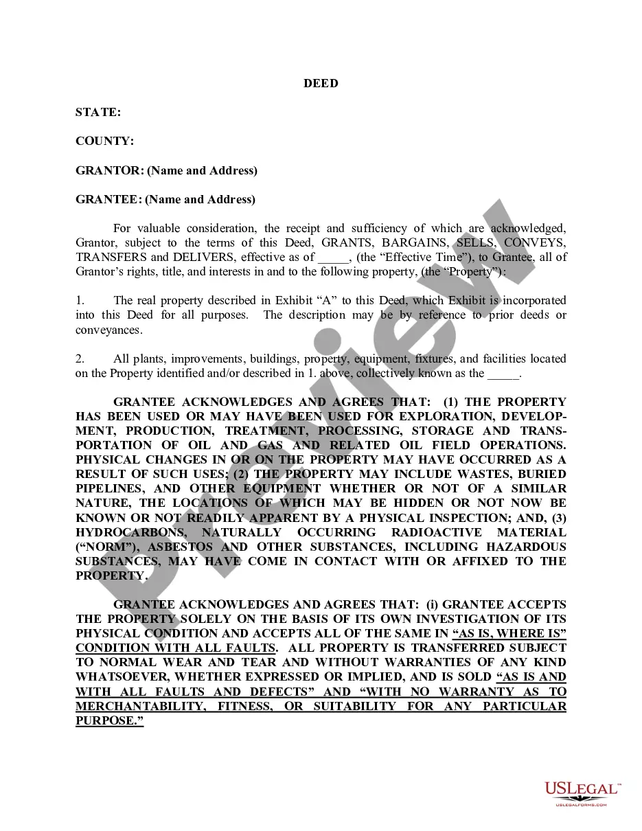
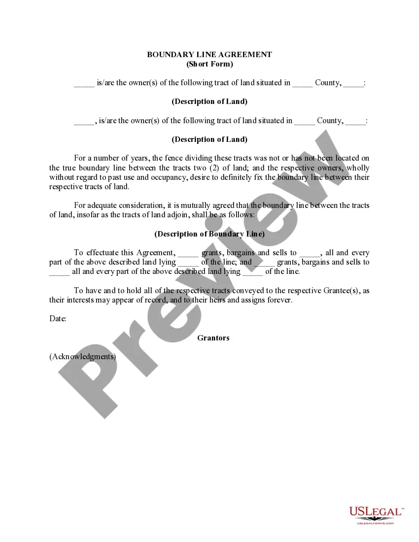
This Boundary Line Agreement and Deed Between Adjacent Land Owners is a legal document used by two property owners to establish the exact location of their property boundary. Its primary purpose is to resolve disputes regarding the boundary line, ensuring clarity in land ownership. This form differs from other property agreements by explicitly addressing both surface and mineral estates, affirming that ownership rights extend to the mineral rights beneath the land.
Form components explained
- Identification of the first owner and their property description.
- Identification of the second owner and their property description.
- A statement establishing the uncertainty about the common boundary line.
- Detail on the agreed-upon boundary line location.
- Transfer of ownership rights, including surface and mineral estates.
- Effective date of the agreement.


Common use cases
This form should be used when two adjacent landowners are uncertain about the exact location of their shared boundary line. It is particularly beneficial when they wish to clarify their property lines to avoid future disputes. Situations may arise from inherited properties, poorly marked land boundaries, or discrepancies in property deeds.
Who should use this form
- Adjacent landowners who have differing views on their property boundary.
- Individuals looking to clarify property lines for development or land use purposes.
- Heirs managing inherited properties with unclear boundaries.
How to complete this form
- Identify both landowners by providing their names and addresses.
- Describe each landowner's property in detail.
- State the effective date of the agreement.
- Outline the agreed boundary line location.
- Include any necessary descriptions or exhibits detailing the lands.
- Ensure both owners sign and acknowledge the form as required.
Notarization requirements for this form
This form needs to be notarized to ensure legal validity. US Legal Forms provides secure online notarization powered by Notarize, allowing you to complete the process through a verified video call, available anytime.
Get your form ready online
Our built-in tools help you complete, sign, share, and store your documents in one place.
Make edits, fill in missing information, and update formatting in US Legal Forms—just like you would in MS Word.
Download a copy, print it, send it by email, or mail it via USPS—whatever works best for your next step.
Sign and collect signatures with our SignNow integration. Send to multiple recipients, set reminders, and more. Go Premium to unlock E-Sign.
If this form requires notarization, complete it online through a secure video call—no need to meet a notary in person or wait for an appointment.
We protect your documents and personal data by following strict security and privacy standards.

Make edits, fill in missing information, and update formatting in US Legal Forms—just like you would in MS Word.

Download a copy, print it, send it by email, or mail it via USPS—whatever works best for your next step.

Sign and collect signatures with our SignNow integration. Send to multiple recipients, set reminders, and more. Go Premium to unlock E-Sign.

If this form requires notarization, complete it online through a secure video call—no need to meet a notary in person or wait for an appointment.

We protect your documents and personal data by following strict security and privacy standards.
Common mistakes to avoid
- Failing to accurately describe the properties involved.
- Neglecting to provide the effective date of the agreement.
- Not obtaining signatures from both parties.
- Overlooking the inclusion of necessary exhibits or descriptions.
Why complete this form online
- Convenience of immediate access and downloading from any location.
- Editable templates allow users to customize details easily.
- Reliability with forms drafted by licensed attorneys.
Looking for another form?

Form popularity
FAQ
Taking the details from the legal description and plat map, a surveyor carefully measures the legal boundaries of your property. The surveyor will bury survey pins if they're not already there and often mark the spots with stakes or flags for easy use.
A boundary fence marks a land division or partition.Every house may own the fence situated on its right side or on its left side. The vendor who divided the land parcels before selling them individually is the one who assigns boundaries ownership and should specify these details in the conveyance deed.
The doctrine provides that when two adjacent owners who are uncertain of the true position of the common boundary between the parcels agree to the true position of the common boundary, mark it on the ground or build it up, and occupy each side for a period equal to the statute of limitations, then such line becomes the
A boundary survey is a way to formally define the boundaries of a property.The dimensions of a lot come from deed, subdivision plats, and survey drawings. They show the exact lines of the property. You can choose to have a boundary survey include any improvements made on the land by previous owners.
A boundary agreement between two neighbouring landowners as to the position of the boundary between their two properties may take effect even where it might be arguablycontrary to evidence pointing to the boundary being in a different place.The agreement, once made, will be binding on successors in title.
1. Side and Rear Yards. Yard structures under six feet in height may be located up to a side or rear property line subject to building code and fire code limitations. Yard structures six feet in height or over shall be located at least three feet from any property line and shall not exceed 12 feet in height.
Boundary responsibility is always mentioned in the Deeds and if it is not then they are party boundaries. Often boundaries are not marked out in terms of precise measurements. The Land Registry Title Plans are always to scale. However, you cannot rely upon this as an accurate measurement to determine the boundaries.