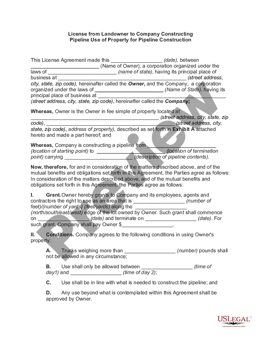
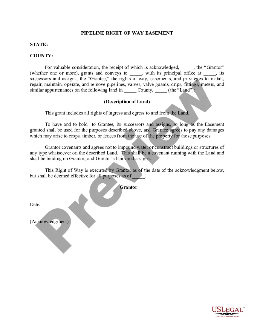
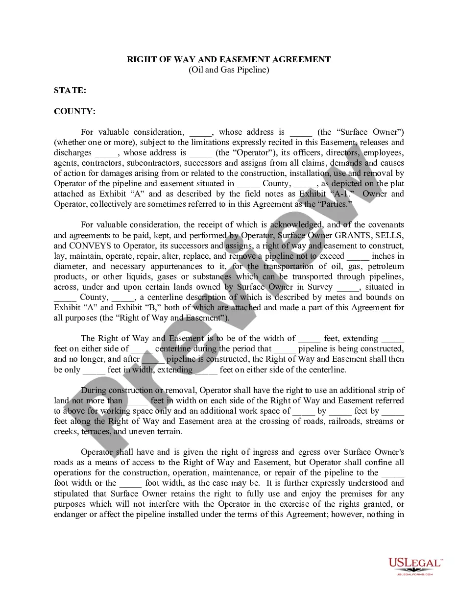
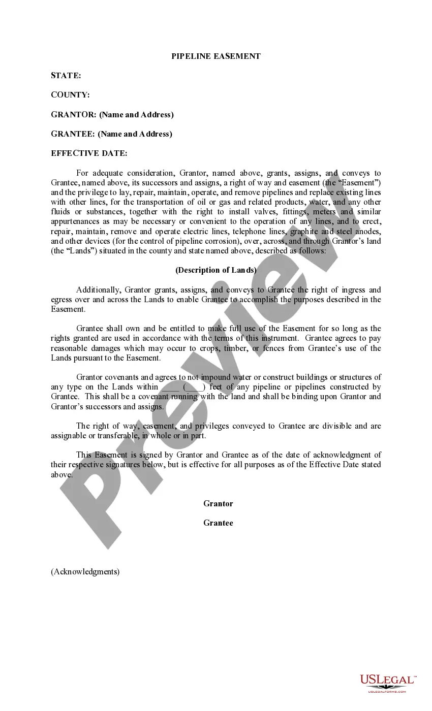
Guam Permission to Survey (Pipeline Right of Way)
Description
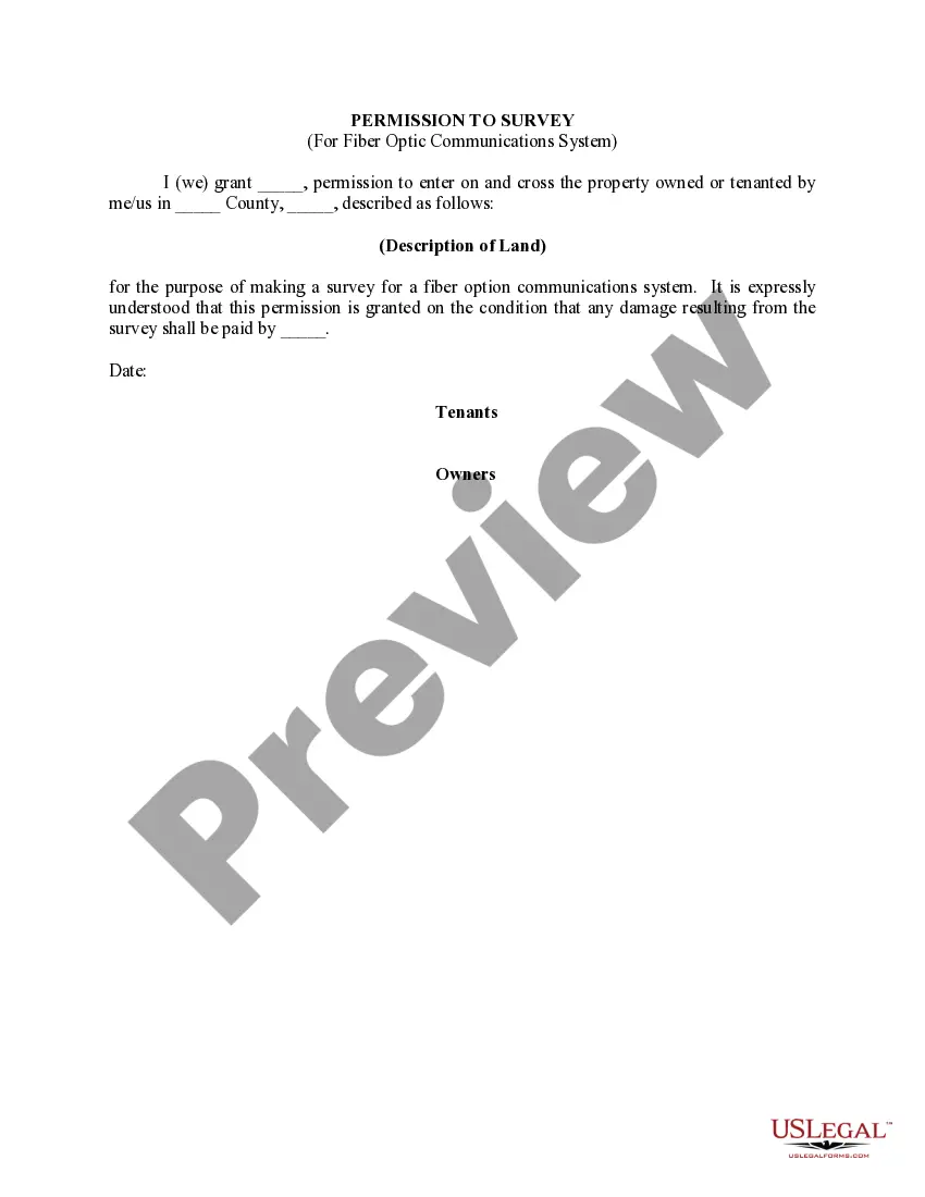
How to fill out Permission To Survey (Pipeline Right Of Way)?
If you wish to full, download, or produce lawful file layouts, use US Legal Forms, the largest assortment of lawful types, that can be found on the Internet. Utilize the site`s simple and convenient lookup to discover the paperwork you require. Various layouts for business and individual purposes are categorized by categories and says, or key phrases. Use US Legal Forms to discover the Guam Permission to Survey (Pipeline Right of Way) with a couple of clicks.
In case you are previously a US Legal Forms consumer, log in for your profile and then click the Down load switch to get the Guam Permission to Survey (Pipeline Right of Way). Also you can entry types you in the past acquired in the My Forms tab of your profile.
Should you use US Legal Forms initially, follow the instructions below:
- Step 1. Be sure you have selected the shape for the correct metropolis/land.
- Step 2. Use the Preview choice to examine the form`s information. Never forget to see the outline.
- Step 3. In case you are unsatisfied with all the form, utilize the Research industry towards the top of the screen to find other versions in the lawful form format.
- Step 4. Once you have discovered the shape you require, click on the Get now switch. Pick the rates strategy you choose and include your qualifications to sign up for the profile.
- Step 5. Approach the purchase. You can utilize your Мisa or Ьastercard or PayPal profile to finish the purchase.
- Step 6. Choose the format in the lawful form and download it on your product.
- Step 7. Full, edit and produce or signal the Guam Permission to Survey (Pipeline Right of Way).
Each and every lawful file format you buy is yours eternally. You possess acces to each form you acquired with your acccount. Click on the My Forms portion and choose a form to produce or download once again.
Be competitive and download, and produce the Guam Permission to Survey (Pipeline Right of Way) with US Legal Forms. There are millions of skilled and state-certain types you can use for your business or individual requirements.
Form popularity
FAQ
Above-ground pipeline markers are used along the permanent right-of-way for easy recognition of the presence of underground pipelines. The markers are typically located in a ?line of sight? manner within the rights-of-way, along streets and at road and railroad crossings.
Living near natural gas pipelines can pose several hazards, including: Explosion: Natural gas is highly flammable and explosive. If there is a leak or rupture in a gas line, it can lead to an explosion that can cause significant damage and harm to people and property nearby.
The chances of a pipeline leak or explosion on your property is relatively small, but the consequences can be huge. Knowing what to do, and what not to do, could save your life.
The hazard area radius is basically the area in proximity to the pipeline within which there would be virtually no chance of survival if a pipeline rupture and fire were to happen, and it varies in size from about 100 feet to about 700 feet for a 6-inch to 42-inch pipeline, respectively.
Natural gas pipelines do not affect the property value of any particular type of residence any more or less than another type of residence.
Proximity to pipeline compressor stations, which release pollutants such as volatile organic compounds and particulate matter, can contribute to respiratory problems, cardiovascular diseases, and other adverse health effects.
The markers are typically located in a ?line of sight? manner within the rights- of-way, along streets and at road and railroad crossings. The markers provide helpful information about what each pipeline transports, who operates the pipeline, and how to contact the pipeline company.
Pipeline surveys are an umbrella term for any land survey completed in service to the placing or maintenance of a pipeline. New pipelines can use land survey data to decide the most efficient route, while existing pipelines are often surveyed when checking for or confirming damage.
")