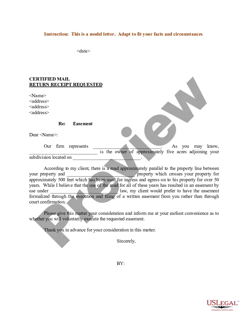
Wisconsin Sample Letter regarding Survey Maps
Description
Get your form ready online
Our built-in tools help you complete, sign, share, and store your documents in one place.
Make edits, fill in missing information, and update formatting in US Legal Forms—just like you would in MS Word.
Download a copy, print it, send it by email, or mail it via USPS—whatever works best for your next step.
Sign and collect signatures with our SignNow integration. Send to multiple recipients, set reminders, and more. Go Premium to unlock E-Sign.
If this form requires notarization, complete it online through a secure video call—no need to meet a notary in person or wait for an appointment.
We protect your documents and personal data by following strict security and privacy standards.

Make edits, fill in missing information, and update formatting in US Legal Forms—just like you would in MS Word.

Download a copy, print it, send it by email, or mail it via USPS—whatever works best for your next step.

Sign and collect signatures with our SignNow integration. Send to multiple recipients, set reminders, and more. Go Premium to unlock E-Sign.

If this form requires notarization, complete it online through a secure video call—no need to meet a notary in person or wait for an appointment.

We protect your documents and personal data by following strict security and privacy standards.
Looking for another form?
How to fill out Sample Letter Regarding Survey Maps?
If you have to total, obtain, or print lawful record layouts, use US Legal Forms, the largest variety of lawful kinds, which can be found on the web. Make use of the site`s easy and practical search to get the paperwork you need. Different layouts for enterprise and individual uses are categorized by types and states, or key phrases. Use US Legal Forms to get the Wisconsin Sample Letter regarding Survey Maps with a few click throughs.
If you are previously a US Legal Forms client, log in to your bank account and click on the Acquire option to find the Wisconsin Sample Letter regarding Survey Maps. Also you can access kinds you previously delivered electronically within the My Forms tab of the bank account.
If you are using US Legal Forms the first time, follow the instructions below:
- Step 1. Make sure you have selected the shape for the appropriate area/land.
- Step 2. Make use of the Preview method to look over the form`s content material. Do not forget about to read the explanation.
- Step 3. If you are unsatisfied together with the type, use the Lookup field on top of the monitor to discover other versions of your lawful type design.
- Step 4. Upon having found the shape you need, go through the Get now option. Choose the rates program you favor and put your qualifications to register for an bank account.
- Step 5. Process the financial transaction. You should use your Мisa or Ьastercard or PayPal bank account to accomplish the financial transaction.
- Step 6. Select the file format of your lawful type and obtain it on the system.
- Step 7. Total, revise and print or indication the Wisconsin Sample Letter regarding Survey Maps.
Each lawful record design you get is your own property forever. You might have acces to every single type you delivered electronically in your acccount. Click the My Forms section and decide on a type to print or obtain again.
Be competitive and obtain, and print the Wisconsin Sample Letter regarding Survey Maps with US Legal Forms. There are millions of professional and status-certain kinds you can utilize for the enterprise or individual demands.
Form popularity
FAQ
Survey Marker Colors and Their Meanings White ? Proposed Excavation. Pink ? Temporary Survey Markings. Red ? Electric Power Lines. Yellow ? Gas, Oil and other Gaseous Materials. Orange ? Communication Lines. Blue ? Potable Water. Purple ? Reclaimed Water and Irrigation Lines. Green ? Sewers and Drain Lines.
A Certified Survey Map (CSM), consisting of 4 or less parcels of. land designated as lots or outlots, may be recorded in the register. of deeds office of the county in which the land is located.
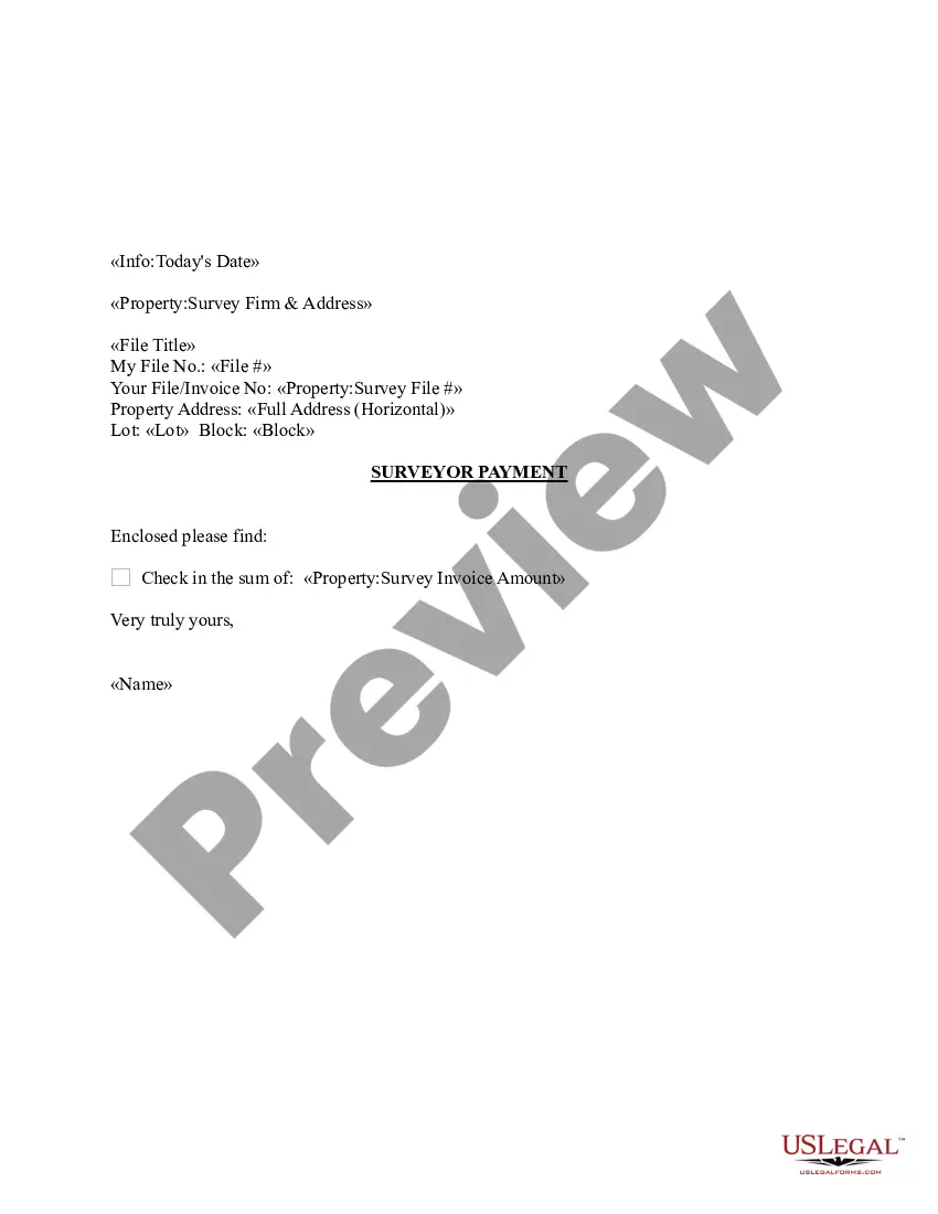
For a rough idea of what you might have to pay, an average land survey is usually around $500. However, this price can easily rise to over $1,000 for a larger piece of land. To get a more accurate idea of the costs for your survey project, contact Scalice Land Surveyors for a free quote.
A Certified Survey Map (CSM), consisting of 4 or less parcels of. land designated as lots or outlots, may be recorded in the register. of deeds office of the county in which the land is located.
Land surveying is the science, art, and profession of determining the positions of points on the surface of the earth and measuring the distances, directions, angles, and elevations between them. This data helps accurately create maps and provide evidence to help courts determine plot boundaries.
Certified Survey Maps are documents used for minor land divisions (land divisions that do not require a Subdivision Plat, as defined in the Wisconsin State Statutes and in the applicable local Land Division or Subdivision Control Ordinance if that is more restrictive), the reconfiguration of lot lines, or the ...