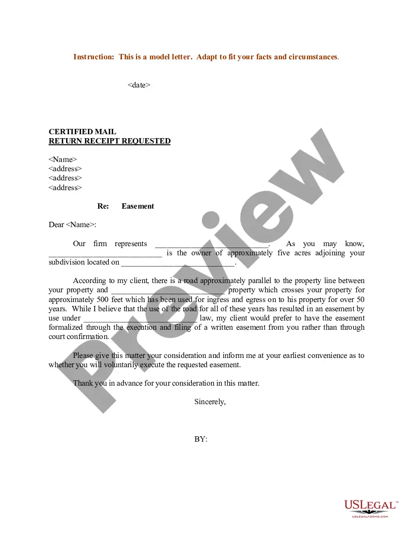
Washington Sample Letter regarding Survey Maps
Description
Get your form ready online
Our built-in tools help you complete, sign, share, and store your documents in one place.
Make edits, fill in missing information, and update formatting in US Legal Forms—just like you would in MS Word.
Download a copy, print it, send it by email, or mail it via USPS—whatever works best for your next step.
Sign and collect signatures with our SignNow integration. Send to multiple recipients, set reminders, and more. Go Premium to unlock E-Sign.
If this form requires notarization, complete it online through a secure video call—no need to meet a notary in person or wait for an appointment.
We protect your documents and personal data by following strict security and privacy standards.

Make edits, fill in missing information, and update formatting in US Legal Forms—just like you would in MS Word.

Download a copy, print it, send it by email, or mail it via USPS—whatever works best for your next step.

Sign and collect signatures with our SignNow integration. Send to multiple recipients, set reminders, and more. Go Premium to unlock E-Sign.

If this form requires notarization, complete it online through a secure video call—no need to meet a notary in person or wait for an appointment.

We protect your documents and personal data by following strict security and privacy standards.
Looking for another form?
How to fill out Sample Letter Regarding Survey Maps?
Discovering the right legal file design can be quite a battle. Of course, there are a variety of web templates available on the Internet, but how can you obtain the legal form you want? Use the US Legal Forms site. The service offers thousands of web templates, including the Washington Sample Letter regarding Survey Maps, that you can use for business and private requires. Each of the types are examined by professionals and fulfill state and federal demands.
Should you be presently listed, log in to the profile and click on the Obtain button to have the Washington Sample Letter regarding Survey Maps. Use your profile to check from the legal types you have purchased in the past. Visit the My Forms tab of your own profile and acquire an additional version in the file you want.
Should you be a whole new end user of US Legal Forms, listed below are easy instructions that you should follow:
- Very first, ensure you have selected the right form for your personal area/area. You are able to look through the form while using Review button and study the form outline to ensure this is the best for you.
- When the form will not fulfill your needs, use the Seach industry to discover the right form.
- When you are sure that the form is proper, select the Buy now button to have the form.
- Choose the rates prepare you need and enter in the necessary information and facts. Design your profile and buy your order with your PayPal profile or Visa or Mastercard.
- Select the document formatting and obtain the legal file design to the device.
- Total, revise and print out and signal the acquired Washington Sample Letter regarding Survey Maps.
US Legal Forms is the most significant local library of legal types where you will find numerous file web templates. Use the company to obtain skillfully-created papers that follow state demands.
Form popularity
FAQ
Any surveyor authorized by the court and the surveyor's employees may, without liability for trespass, enter upon any land or waters and remain there while performing the duties as required in RCW 58.04.
Ing to Washington State law, when a person erects a fence on their property boundary line, and the adjoining landowner uses that fence to enclose their property, the adjoining landowner is required to pay the fence owner half the value of the partition fence.
There are various reasons that may necessitate the need for records of surveys, such as verifying the acreage of your parcel of land, checking for possible encroachments by adjoining properties or for the development of your property.
Land surveying allows you to understand your land boundaries. A survey is performed in order to locate, describe, monument, and map the boundaries and corners of a parcel of land. It might also include the topography of the parcel, and the location of buildings and other improvements made to the parcel.
* The State of Washington requires that a Record of Survey map be recorded with the governing agency (County) within 90 days of the completion of work, when establishing a property boundary, not previously established, and/or locating any encroachment issues, and /or placing any licensed monuments/stakes. RCW 58.09.
In addition to the public surveys he made on the western frontiers of the Northern Neck, Washington prepared two remarkable maps of the area that became the , Virginia, on the Potomac River. The earliest is the Plat of the Land whereon now Stands the Town of Alexandria, drawn in 1748.
After August 15, 2018, a landowner may use signs or fluorescent orange paint. Provides that a landowner must post signs at the entrance of roads located on private property. As of August 15, 2013, a landowner must post signs and paint fluorescent orange paint on trees or posts to provide notice against trespass.
Steps to Survey Your Property with GPS Step 1: Plan Your Survey. Before you start surveying, it's important to have a clear plan in place. ... Step 2: Set Up Your GPS Receiver. ... Step 3: Collect Data. ... Step 4: Transfer Data to Mapping Software. ... Step 5: Analyze and Interpret the Data. ... Step 6: Use Your Survey Data.