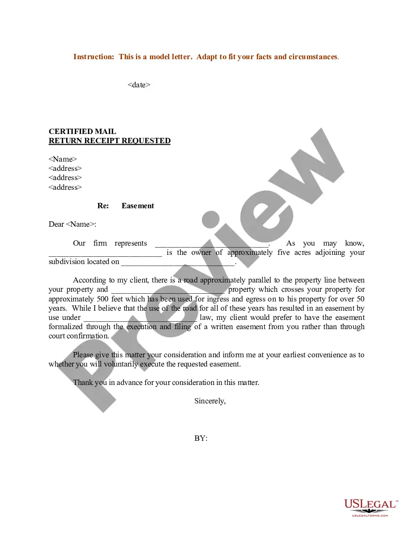
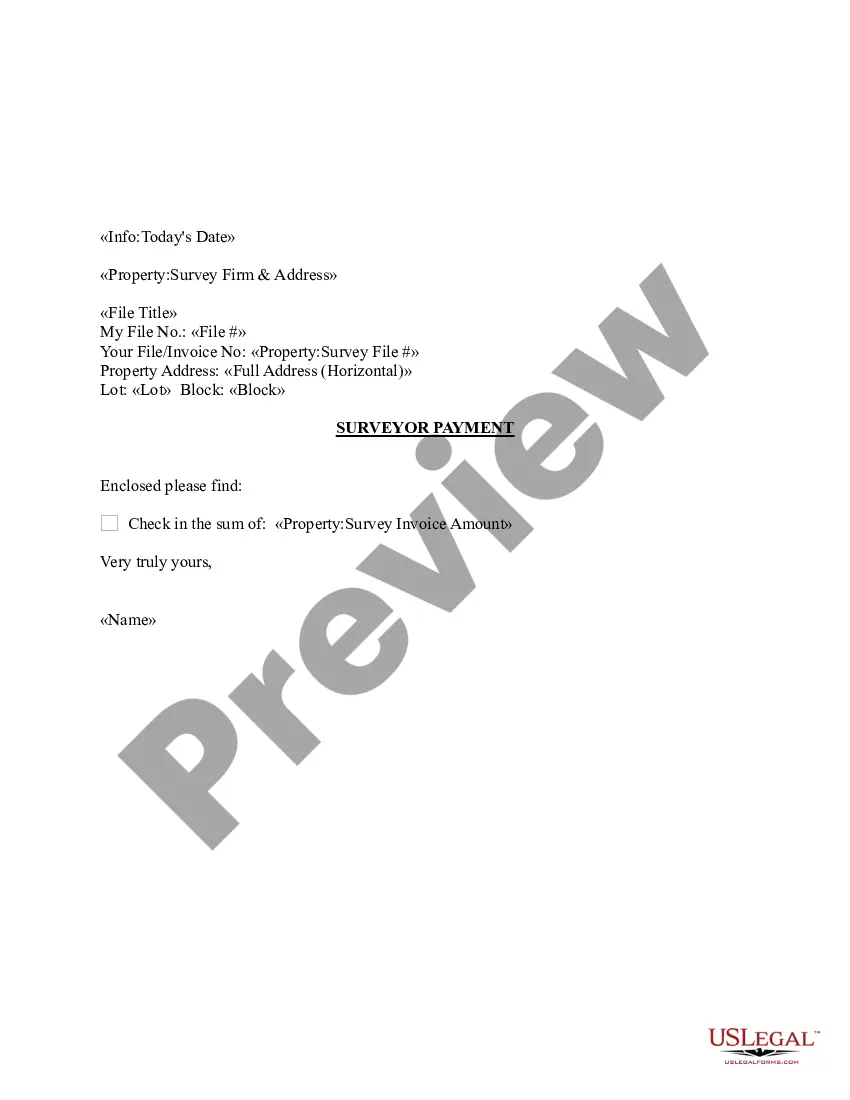
Virgin Islands Sample Letter regarding Survey Maps
Description
Get your form ready online
Our built-in tools help you complete, sign, share, and store your documents in one place.
Make edits, fill in missing information, and update formatting in US Legal Forms—just like you would in MS Word.
Download a copy, print it, send it by email, or mail it via USPS—whatever works best for your next step.
Sign and collect signatures with our SignNow integration. Send to multiple recipients, set reminders, and more. Go Premium to unlock E-Sign.
If this form requires notarization, complete it online through a secure video call—no need to meet a notary in person or wait for an appointment.
We protect your documents and personal data by following strict security and privacy standards.
Make edits, fill in missing information, and update formatting in US Legal Forms—just like you would in MS Word.
Download a copy, print it, send it by email, or mail it via USPS—whatever works best for your next step.
Sign and collect signatures with our SignNow integration. Send to multiple recipients, set reminders, and more. Go Premium to unlock E-Sign.

If this form requires notarization, complete it online through a secure video call—no need to meet a notary in person or wait for an appointment.
We protect your documents and personal data by following strict security and privacy standards.
Looking for another form?


How to fill out Sample Letter Regarding Survey Maps?
If you have to total, acquire, or print legal file templates, use US Legal Forms, the biggest collection of legal varieties, that can be found on the web. Utilize the site`s basic and practical look for to get the paperwork you want. Numerous templates for business and personal functions are categorized by groups and states, or keywords. Use US Legal Forms to get the Virgin Islands Sample Letter regarding Survey Maps in just a handful of click throughs.
Should you be previously a US Legal Forms buyer, log in for your account and then click the Download switch to obtain the Virgin Islands Sample Letter regarding Survey Maps. You can even entry varieties you formerly delivered electronically within the My Forms tab of your respective account.
If you use US Legal Forms the very first time, refer to the instructions beneath:
- Step 1. Make sure you have selected the shape for that right town/region.
- Step 2. Use the Preview solution to look through the form`s information. Do not forget about to see the outline.
- Step 3. Should you be unhappy with all the type, make use of the Research industry on top of the monitor to find other models of your legal type design.
- Step 4. Upon having found the shape you want, click the Purchase now switch. Choose the pricing plan you choose and add your qualifications to register for an account.
- Step 5. Procedure the transaction. You can utilize your charge card or PayPal account to finish the transaction.
- Step 6. Pick the format of your legal type and acquire it on the system.
- Step 7. Comprehensive, revise and print or indicator the Virgin Islands Sample Letter regarding Survey Maps.
Each and every legal file design you acquire is the one you have for a long time. You possess acces to every single type you delivered electronically in your acccount. Go through the My Forms segment and pick a type to print or acquire yet again.
Remain competitive and acquire, and print the Virgin Islands Sample Letter regarding Survey Maps with US Legal Forms. There are many specialist and express-certain varieties you can use to your business or personal requirements.
Form popularity
FAQ
From budget restaurants to mid-range eateries, you can expect to spend around $10 to $30 per person for a meal. If you're a budget traveler, you can expect to spend around $50 to $100 per day in the U.S. Virgin Islands. This includes accommodation, food, transportation, and some activities.
* You may retrieve uncertified copies of the marriage license by logging in to your E-File account and going to the docket of your marriage. family-stt@vicourts.org for St.
Ing to VI Now website, construction cost per square foot ranges from $275 -$400 (masonry) in the US Virgin Islands, with St. Croix being on the low end and St. John on the high end, with St. Thomas somewhere in the $300s.
What is the cheapest Virgin Island to stay at? If you're looking to save on your trip, you may want to consider the cheapest virgin island to stay at. St. Thomas is your best bet if you're looking for savings.
Below is a breakdown of stamp taxes present in the U.S. Virgin Islands: 2% for properties valued at $350,000. 2 ½ % for properties valued to the excess of $350,001 to 1 million. 3 % for properties valued to the excess of $1,000,001 to $5 million.
(l) For Assignments of Mortgage and Leasehold Interest for several properties, the recording fees shall be $25.00 for the document and $4.00 for each property or unit attached; for certified copies, the recording fees shall be $10.00 for the first page and $1.00 for each additional page; for Certificates of Death, the ...