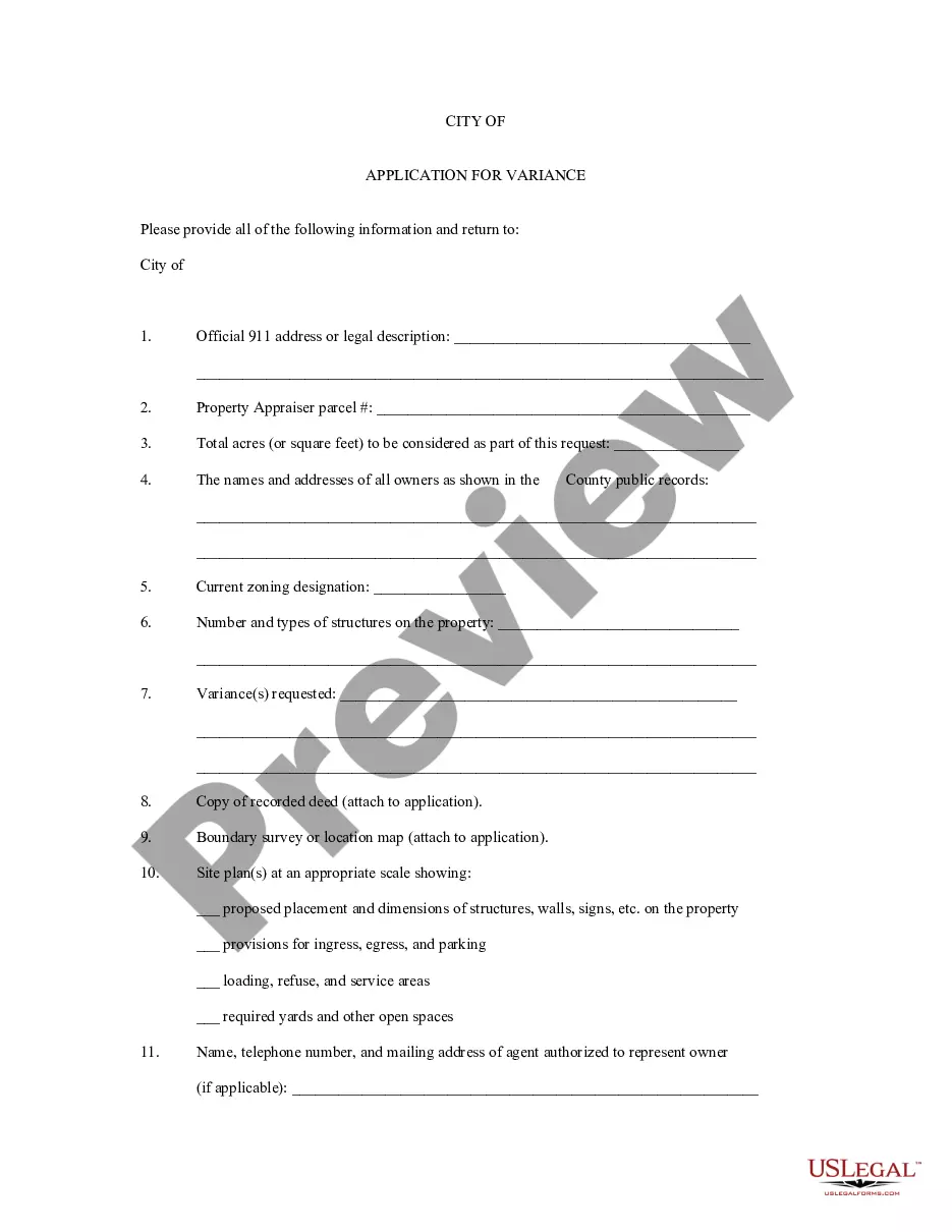
North Carolina Application for Rezoning and / or Future Land Use Map Amendment
Description


How to fill out Application For Rezoning And / Or Future Land Use Map Amendment?
Finding the right legal file format might be a have difficulties. Of course, there are a variety of web templates available online, but how do you find the legal develop you want? Utilize the US Legal Forms internet site. The assistance delivers a large number of web templates, such as the North Carolina Application for Rezoning and / or Future Land Use Map Amendment, which can be used for organization and personal demands. Each of the types are checked out by experts and satisfy state and federal demands.
When you are previously listed, log in to your bank account and click on the Acquire key to have the North Carolina Application for Rezoning and / or Future Land Use Map Amendment. Utilize your bank account to appear with the legal types you have bought in the past. Visit the My Forms tab of your respective bank account and obtain an additional version of your file you want.
When you are a fresh customer of US Legal Forms, here are easy recommendations so that you can stick to:
- Very first, make certain you have selected the correct develop for your town/region. You may look over the shape making use of the Preview key and read the shape explanation to ensure it is the right one for you.
- In the event the develop fails to satisfy your needs, utilize the Seach discipline to find the proper develop.
- When you are sure that the shape is proper, go through the Purchase now key to have the develop.
- Choose the rates strategy you desire and enter in the necessary info. Create your bank account and pay for the order making use of your PayPal bank account or credit card.
- Pick the data file formatting and down load the legal file format to your gadget.
- Comprehensive, modify and produce and signal the received North Carolina Application for Rezoning and / or Future Land Use Map Amendment.
US Legal Forms will be the largest local library of legal types that you can discover various file web templates. Utilize the service to down load professionally-created papers that stick to condition demands.
Form popularity
FAQ
Land is typically zoned for residential, commercial, or industrial use. Within each of these zones, there may be further divisions. As an example, a piece of land zoned for commercial use may only permit the operation of certain types of businesses.
Conditional zoning is established to provide flexibility in the development of property while ensuring that a development is compatible with neighboring uses. Conditional zoning affords a degree of certainty in land use decisions not typically possible in conventional zoning.
The RA-20M Residential/Agricultural District (RA-20M) is established primarily to support agricultural and residential development. Inclusive in such higher density residential developments may consist of single-family dwellings, multifamily dwellings, duplexes, and manufactured home parks.
To request a Rezoning, please fill out a Map Amendment application. The Rezoning process begins when a completed application, survey of area to be rezoned and the required nonrefundable fee are submitted by the appropriate deadline. The Application is then checked for accuracy by the Planning staff.
A rezoning applicant must conduct a neighborhood meeting and attend a pre-application conference before they may submit a rezoning application. The applicant is required to provide records of these meetings with their completed rezoning application form.
The R-40 District is intended to accommodate low-density residential development, as either single-family detached or attached dwellings on separate lots.