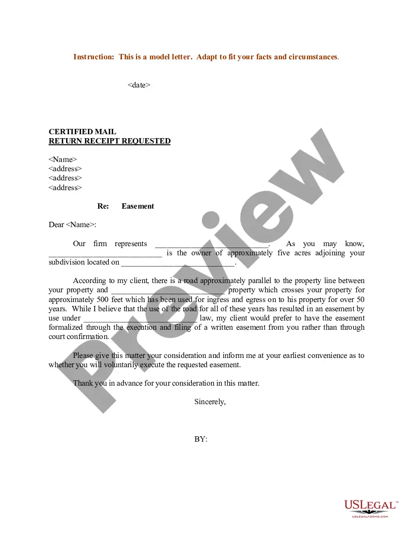
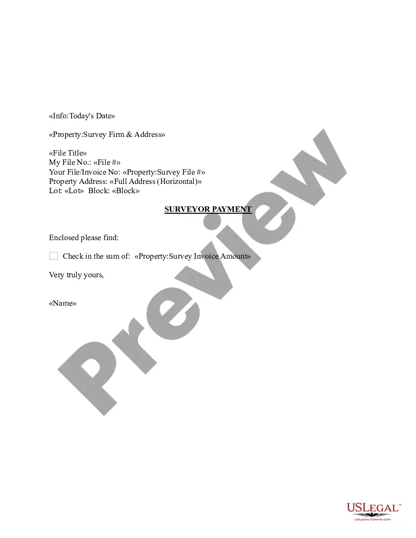
Louisiana Sample Letter regarding Survey Maps
Description
Get your form ready online
Our built-in tools help you complete, sign, share, and store your documents in one place.
Make edits, fill in missing information, and update formatting in US Legal Forms—just like you would in MS Word.
Download a copy, print it, send it by email, or mail it via USPS—whatever works best for your next step.
Sign and collect signatures with our SignNow integration. Send to multiple recipients, set reminders, and more. Go Premium to unlock E-Sign.
If this form requires notarization, complete it online through a secure video call—no need to meet a notary in person or wait for an appointment.
We protect your documents and personal data by following strict security and privacy standards.

Make edits, fill in missing information, and update formatting in US Legal Forms—just like you would in MS Word.

Download a copy, print it, send it by email, or mail it via USPS—whatever works best for your next step.

Sign and collect signatures with our SignNow integration. Send to multiple recipients, set reminders, and more. Go Premium to unlock E-Sign.

If this form requires notarization, complete it online through a secure video call—no need to meet a notary in person or wait for an appointment.

We protect your documents and personal data by following strict security and privacy standards.
Looking for another form?


How to fill out Sample Letter Regarding Survey Maps?
It is possible to devote hours on the Internet looking for the legal record design that fits the state and federal specifications you want. US Legal Forms provides 1000s of legal varieties which can be evaluated by experts. It is simple to obtain or produce the Louisiana Sample Letter regarding Survey Maps from our assistance.
If you already have a US Legal Forms account, you can log in and click the Acquire key. After that, you can complete, revise, produce, or signal the Louisiana Sample Letter regarding Survey Maps. Each legal record design you buy is your own for a long time. To get one more version of any obtained develop, check out the My Forms tab and click the corresponding key.
Should you use the US Legal Forms website the first time, adhere to the basic instructions under:
- Initial, ensure that you have selected the proper record design for the area/city that you pick. Look at the develop explanation to ensure you have chosen the appropriate develop. If offered, utilize the Preview key to look throughout the record design also.
- If you want to discover one more version of your develop, utilize the Lookup field to find the design that meets your requirements and specifications.
- When you have discovered the design you want, click on Buy now to move forward.
- Find the rates program you want, key in your qualifications, and register for an account on US Legal Forms.
- Comprehensive the financial transaction. You can utilize your credit card or PayPal account to cover the legal develop.
- Find the file format of your record and obtain it for your system.
- Make changes for your record if possible. It is possible to complete, revise and signal and produce Louisiana Sample Letter regarding Survey Maps.
Acquire and produce 1000s of record web templates using the US Legal Forms site, that provides the largest assortment of legal varieties. Use expert and state-particular web templates to tackle your organization or personal needs.
Form popularity
FAQ
Boundary Surveys Measure Property Lines In contrast to something like a topographic survey, which measures terrain and elevation, a boundary survey measures distance.
Size Property SizeCost1 acre$200 ? $5005 acres$1,000 ? $2,50010 acres$2,000 ? $5,000
Generally, the answer to that question is YES, it is illegal. Only government officials with a permissible purpose, such as a cadastral land resurvey, should remove or alter permanent survey markers.
1. Boundary Survey. This type of land survey is used to locate the corners and property boundary lines of a parcel of land. A boundary survey will use both recorded deeds and physical markers to define the boundary lines on a piece of land.
Boundary surveys are typically performed to obtain building permits, to resolve property disputes, and for erecting fences. A topographic survey locates all improvements and topographical features such as elevations of the land, embankments, contours, trees, watercourses, roads, ditches, utilities, etc.
A boundary survey is a formal means of defining the boundaries of a property. It is primarily concerned with determining the corners of a parcel of land. Before buying, dividing, improving, or building on land, most people hire a boundary surveyor.
The cost of a land survey can range from $1,500 to over $6,000 for larger properties in Canada. However, the cost of the survey depends on the size of the property and the type of survey being completed.
Property lines, or boundary lines, define the points where properties begin and end. These boundaries are used when installing features such as fences, pools and home additions. Some property lines have physical markers, whereas others are invisible.