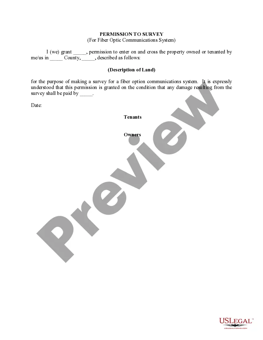
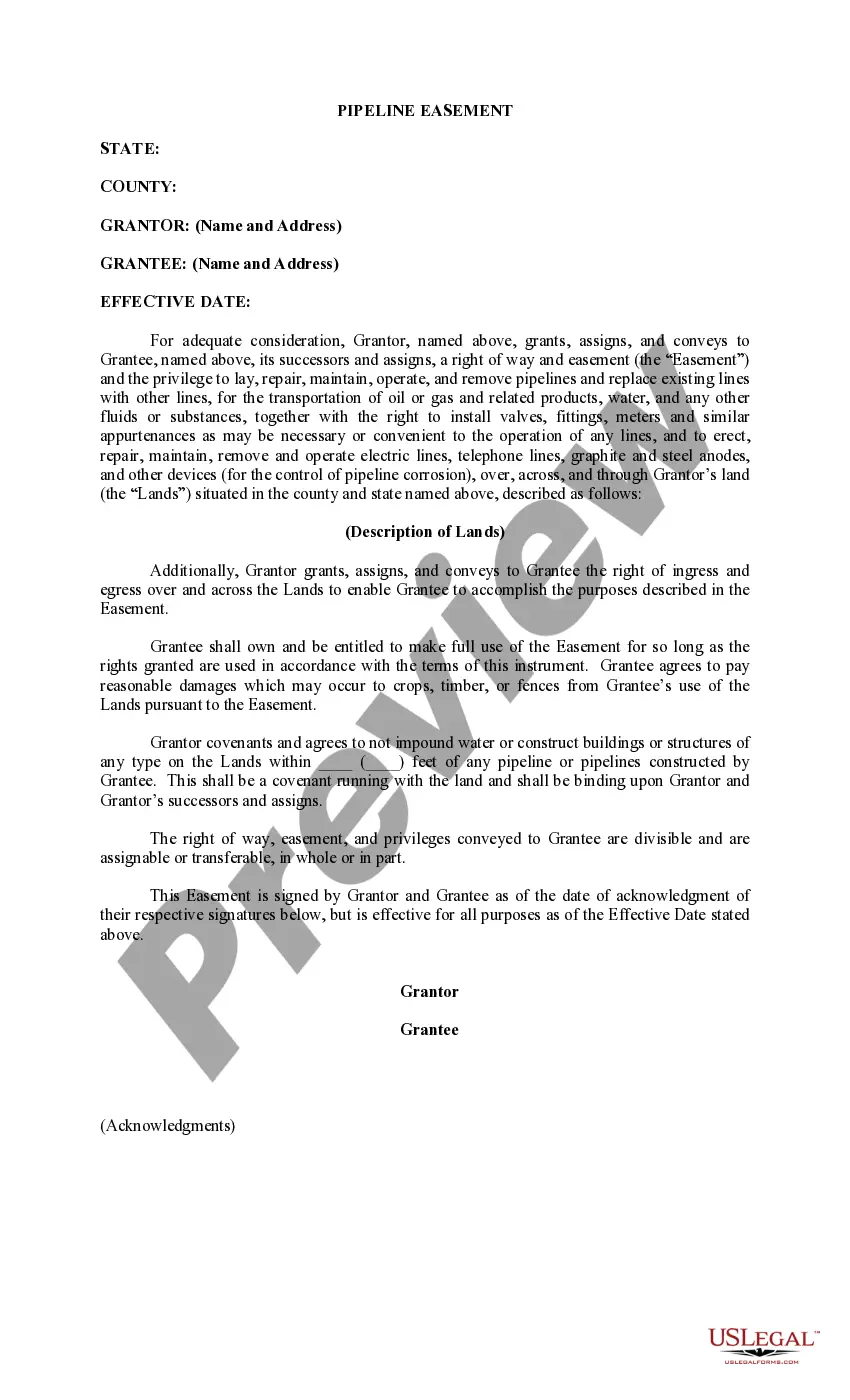
Washington Permission to Survey (Pipeline Right of Way)
Description

How to fill out Permission To Survey (Pipeline Right Of Way)?
Choosing the best authorized record template can be a have a problem. Obviously, there are a variety of themes accessible on the Internet, but how would you find the authorized type you will need? Make use of the US Legal Forms web site. The support provides a large number of themes, for example the Washington Permission to Survey (Pipeline Right of Way), that you can use for business and personal requires. All of the kinds are checked by specialists and fulfill federal and state specifications.
In case you are previously signed up, log in to the bank account and then click the Down load key to get the Washington Permission to Survey (Pipeline Right of Way). Make use of your bank account to check with the authorized kinds you have bought earlier. Proceed to the My Forms tab of your own bank account and have an additional duplicate of the record you will need.
In case you are a fresh user of US Legal Forms, here are basic directions so that you can adhere to:
- First, be sure you have chosen the appropriate type for your town/county. It is possible to look through the form utilizing the Review key and look at the form outline to make certain this is the right one for you.
- When the type will not fulfill your needs, make use of the Seach area to find the correct type.
- Once you are positive that the form is acceptable, select the Buy now key to get the type.
- Select the prices plan you would like and enter in the essential details. Design your bank account and pay money for the transaction using your PayPal bank account or charge card.
- Pick the data file format and down load the authorized record template to the gadget.
- Complete, modify and print out and indication the acquired Washington Permission to Survey (Pipeline Right of Way).
US Legal Forms will be the most significant library of authorized kinds in which you will find a variety of record themes. Make use of the company to down load professionally-produced documents that adhere to state specifications.
Form popularity
FAQ
* The State of Washington requires that a Record of Survey map be recorded with the governing agency (County) within 90 days of the completion of work, when establishing a property boundary, not previously established, and/or locating any encroachment issues, and /or placing any licensed monuments/stakes. RCW 58.09.
Property Surveying Record Process A licensed surveyor or licensed civil engineer must prepare the record of survey in conformity with the practice of land surveying. See BPS § 8762.
A pipeline right-of-way (ROW) is a strip of land of varying widths that may contain one or more pipelines. To deliver critically needed natural gas via our network, Enbridge must at times cross private and public lands.
Authorization to enter upon any land or waters for purpose of resolving dispute. Any surveyor authorized by the court and the surveyor's employees may, without liability for trespass, enter upon any land or waters and remain there while performing the duties as required in RCW 58.04. 001 through 58.04.
Above-ground pipeline markers are used along the permanent right-of-way for easy recognition of the presence of underground pipelines. The markers are typically located in a ?line of sight? manner within the rights-of-way, along streets and at road and railroad crossings.
Ing to Washington State law, when a person erects a fence on their property boundary line, and the adjoining landowner uses that fence to enclose their property, the adjoining landowner is required to pay the fence owner half the value of the partition fence.
As a rule of thumb, the person who requests the survey is the one that pays for it. That means if you are selling a property and the buyer wants a survey of your land, they are responsible for paying. For residential transfers, typically the buyer pays for the mortgage location. Of course, anything is negotiable.
ofway use permit (limited or extended) is required for any private improvement or use of a county rightofway. Limited ROW use permits are required for any construction. Extended ROW use permits are required for long term use, such as for a privately maintained road.
")