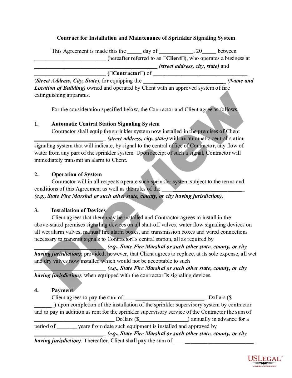
Boundary Line For In Allegheny
Description


Get your form ready online
Our built-in tools help you complete, sign, share, and store your documents in one place.
Make edits, fill in missing information, and update formatting in US Legal Forms—just like you would in MS Word.
Download a copy, print it, send it by email, or mail it via USPS—whatever works best for your next step.
Sign and collect signatures with our SignNow integration. Send to multiple recipients, set reminders, and more. Go Premium to unlock E-Sign.
If this form requires notarization, complete it online through a secure video call—no need to meet a notary in person or wait for an appointment.
We protect your documents and personal data by following strict security and privacy standards.

Make edits, fill in missing information, and update formatting in US Legal Forms—just like you would in MS Word.

Download a copy, print it, send it by email, or mail it via USPS—whatever works best for your next step.

Sign and collect signatures with our SignNow integration. Send to multiple recipients, set reminders, and more. Go Premium to unlock E-Sign.

If this form requires notarization, complete it online through a secure video call—no need to meet a notary in person or wait for an appointment.

We protect your documents and personal data by following strict security and privacy standards.
Looking for another form?


Form popularity
FAQ
Deeds Specific Guidelines. Deed Copies. 412-350-4224. Deed Mapping and Registry. 412-350-5024. Deed Certification. 412-350-5021.
It takes about two to three weeks. The papers are sent back to the person who records them in most cases a Title Company or Attorney. We require a self-addressed stamped envelope if they are to be returned by mail. 7.
Call the Allegheny County Department of Court Records at (412) 350-4201 and tell them you're looking for information on a legal name change. They will describe the entire process to you, including estimated costs, and mail you the necessary forms. As of September 2017, these are the name change petition forms.
In Allegheny County, the realty transfer tax ranges from 2%-5% of the total consideration of a property, with 1% submitted to the State, and the remainder going to the Municipality and School District for the property.
When exploring the world on Google Maps, you might see different styles, borders and labels.
Draw a line or shape On your computer, sign in to My Maps. Open or create a map. Click Draw a line. Select a layer and click where to start drawing. Click each corner or bend of your line or shape. When you're finished drawing, double-click or complete the shape. Give your line or shape a name.
Municipalities in Pennsylvania by county and class COUNTYMUNICIPALITYCLASS Allegheny Aleppo Township 1st Township Allegheny Aspinwall Borough Borough Allegheny Avalon Borough Borough Allegheny Baldwin Borough Borough46 more rows
Google Maps for displaying property lines, follow these simple steps: Step 1: Open Google Maps. Step 2: Search for the Desired Location. Step 3: Switch to Satellite View. Step 4: Enable the 'Measure Distance' Tool. Step 5: Draw the Property Lines.
Find boundaries by using the search box; click anywhere on the map to see information for the selected polygon. Use the menu to select different types of boundaries. Use the checkbox to constrain search results to the selected feature type.
Once you have searched the property address, you will be presented with a standard default map. Next, tap the “+” button located at the lower right-hand corner of the screen to continue zooming in. Continue to zoom in on the property you are interested in until you spot those property lines.
