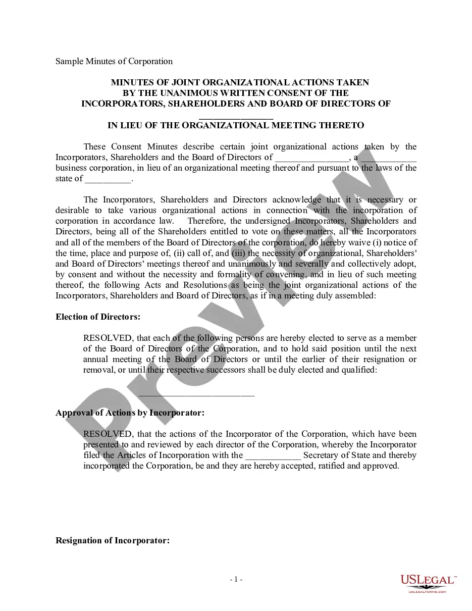
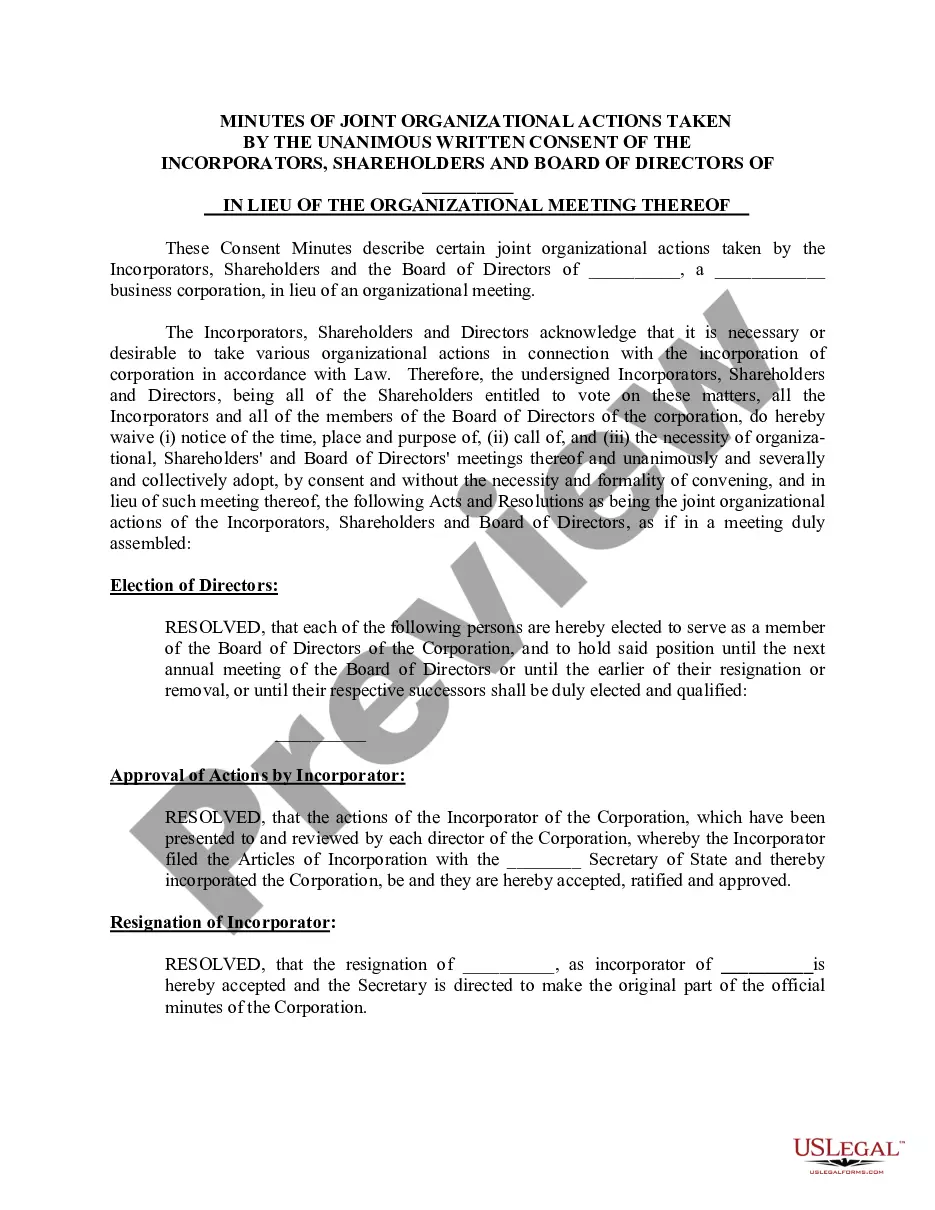
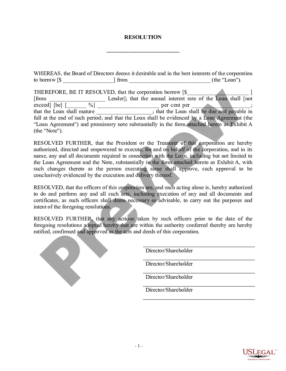
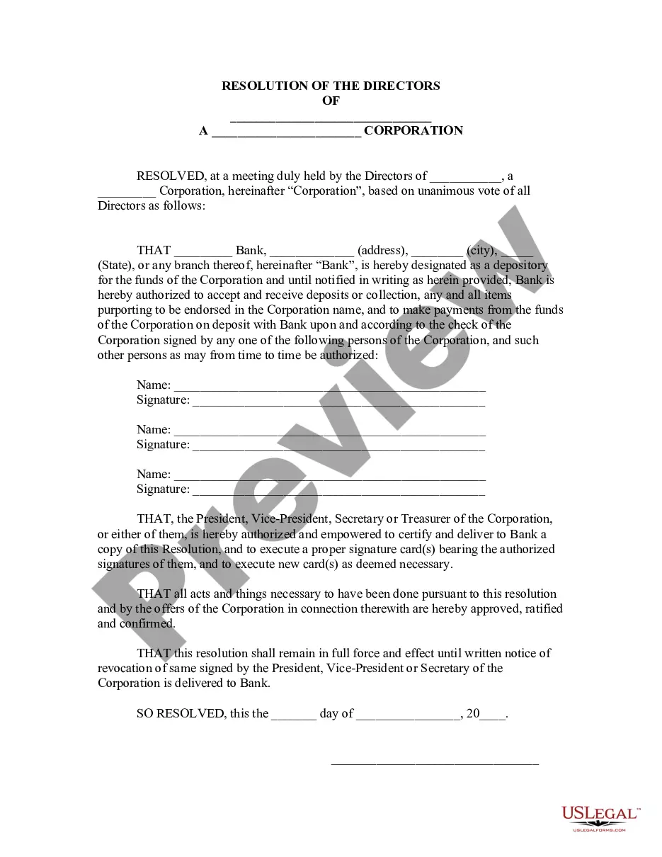
Borrowing For Commercial Property In Hennepin
Description


Get your form ready online
Our built-in tools help you complete, sign, share, and store your documents in one place.
Make edits, fill in missing information, and update formatting in US Legal Forms—just like you would in MS Word.
Download a copy, print it, send it by email, or mail it via USPS—whatever works best for your next step.
Sign and collect signatures with our SignNow integration. Send to multiple recipients, set reminders, and more. Go Premium to unlock E-Sign.
If this form requires notarization, complete it online through a secure video call—no need to meet a notary in person or wait for an appointment.
We protect your documents and personal data by following strict security and privacy standards.

Make edits, fill in missing information, and update formatting in US Legal Forms—just like you would in MS Word.

Download a copy, print it, send it by email, or mail it via USPS—whatever works best for your next step.

Sign and collect signatures with our SignNow integration. Send to multiple recipients, set reminders, and more. Go Premium to unlock E-Sign.

If this form requires notarization, complete it online through a secure video call—no need to meet a notary in person or wait for an appointment.

We protect your documents and personal data by following strict security and privacy standards.
Looking for another form?


Form popularity
FAQ
Today's commercial mortgage rates Freddie Mac Optigo. 5.34% - 6.86% Fannie Mae. 5.54% - 6.81% HUD 223(f) 6.00% - 6.70% CMBS. 6.33% - 7.93% Regional Banks/Credit Unions. 6.77% - 10.50% Life Insurance Companies. 5.58% - 7.06% Debt Funds. 9.12% - 15.37% HUD 221(d)(4) 6.60% - 7.30%
A general warranty deed is used to transfer an interest in real estate in Minnesota in most real estate transactions. A Minnesota warranty deed conveys real property with warranty covenants to the buyer. It requires an acknowledgement of the grantor's signature.
You typically have to get permission from the city to do this and that usually requires providing them with detailed plans and attending city planning meetings. Your property has to meet certain rules and standards to ensure it complies with commercial standards and building codes.
Fannie Mae offers residential mortgage financing for properties being used for both residential and commercial business purposes simultaneously. The property must be a one-unit building that is residential. The property cannot be modified in a way that would hurt the ability to market as a residential property.
Parcel boundary data, maps and ownership records are maintained at the county level, usually by the recorder's, assessor's or land surveyor's offices. Many Minnesota counties keep records in digital format and provide parcel information websites for use by the general public.
The following should help you find out who owns property in California so you can approach them about potential deals. Contact the county tax assessor's office. Reach out to the county clerk or recorder. Knowing the property owner isn't always enough. Get accurate information quickly from a membership database.
How To Get A Plat Map Of Your Property Contact your local government office or check their website. Reach out to your title company and request a copy. Go through the paperwork you received when you purchased the home.
You may come into the Recorder's Office and look at the official plat, order a copy online by entering the name of the plat instead of the document number, search for the property on LandShark GIS, search/download the plat using LandShark online searching, or contact the Public Works Department at 651-213-8700.
Parcel boundary data, maps and ownership records are maintained at the county level, usually by the recorder's, assessor's or land surveyor's offices. Many Minnesota counties keep records in digital format and provide parcel information websites for use by the general public.