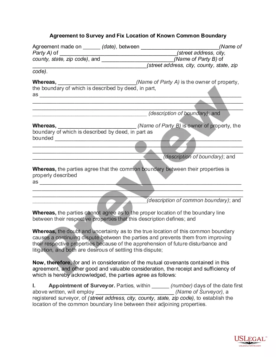
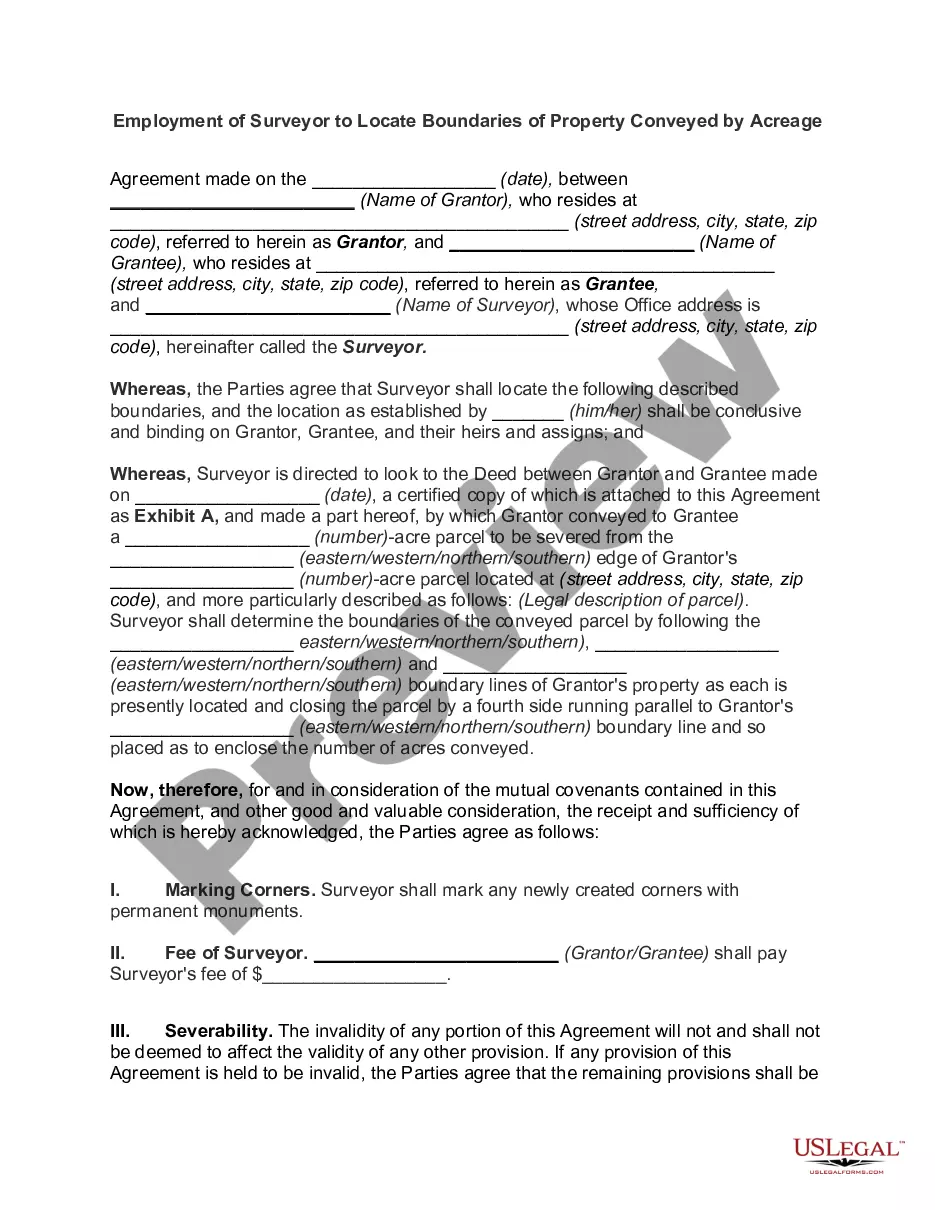
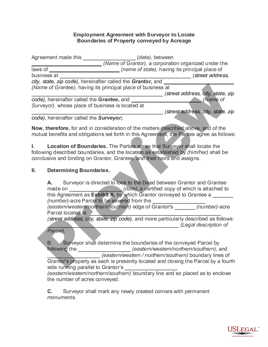
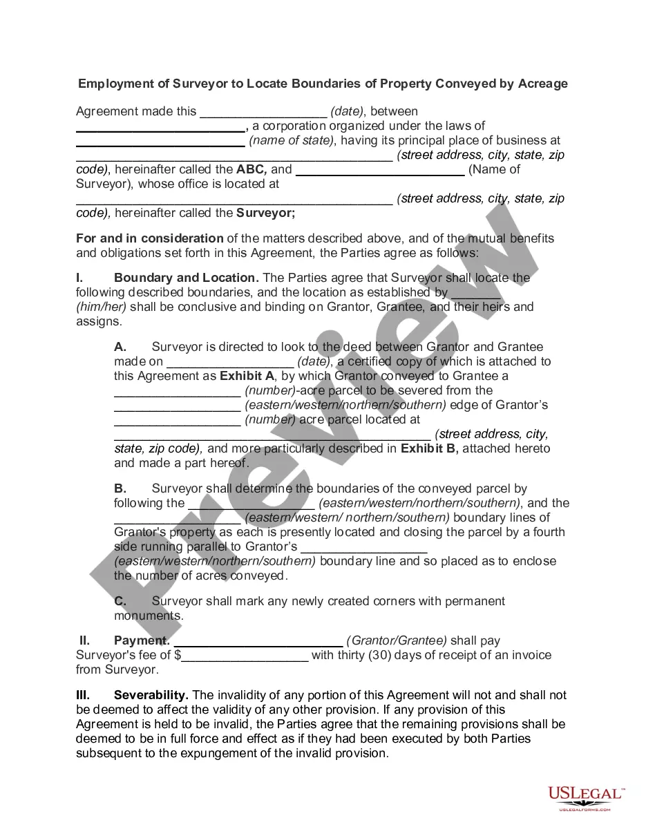
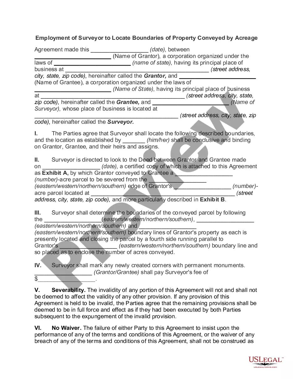
This is a generic sample of an agreement between two adjoining landowners to hire a surveyor to survey their lands in order to settle a dispute as to where the true boundary is regarding their properties.
Santa Clara California Employment of Surveyor by Adjoining Landowners to Locate Disputed Boundary Line
Category:
State:
Multi-State
County:
Santa Clara
Control #:
US-00979BG
Format:
Word;
Rich Text
Instant download
Description
Free preview


How to fill out Employment Of Surveyor By Adjoining Landowners To Locate Disputed Boundary Line?
If you wish to obtain a dependable legal document provider to acquire the Santa Clara Employment of Surveyor by Adjacent Landowners to Identify Contested Boundary Line, think about US Legal Forms. Whether you aim to establish your LLC enterprise or manage your asset allocation, we have you supported. You don’t have to be an expert in law to discover and retrieve the necessary template.
Simply input your search query or explore Santa Clara Employment of Surveyor by Adjacent Landowners to Identify Contested Boundary Line, by either a keyword or by the state/county meant for the document.
Once you find the needed template, you can Log In and download it or save it in the My documents section.
Don’t have an account? Starting is straightforward! Just find the Santa Clara Employment of Surveyor by Adjacent Landowners to Identify Contested Boundary Line template and review the form's preview and description (if provided). If you feel at ease with the template’s wording, proceed to Buy now. Establish an account and select a subscription plan. The template will be promptly available for download as soon as your payment is finalized. You can then fill out the form.
Managing your legal affairs doesn’t need to be costly or lengthy. US Legal Forms is here to demonstrate it. Our vast array of legal documents makes this process more economical and accessible. Launch your first company, organize your advance care directives, draft a real estate contract, or carry out the Santa Clara Employment of Surveyor by Adjacent Landowners to Identify Contested Boundary Line - all from the comfort of your couch. Sign up for US Legal Forms today!
- You can choose from more than 85,000 forms categorized by state/county and case.
- The intuitive interface, abundance of instructional resources, and dedicated assistance facilitate the process of finding and filling out different paperwork.
- US Legal Forms has been a reputable service supplying legal documents to millions of clients since 1997.
Form popularity
FAQ
A definitional dispute is a boundary dispute over the legal terms set forth, a locational dispute is a boundary dispute over the physical location, and an operational dispute is a boundary dispute over how the boundary ought to function.
There are presently two ways in which boundary disputes can be resolved by the Courts: Make an application to HM Land Registry. This might be to alter the register, or to have the boundary determined (this does not refer to a decision by the registrar, but to an entry on the register defining the boundaries).
The cost of a topographical land survey is based on the size of your land and how long the survey takes. This can cost between £400 and £1000 per day.
Surveyors can advise on issues arising from boundary disputes, including how boundaries are defined and how they can be identified.
Sometimes, despite your best efforts, the only way to settle a boundary dispute is via litigation. There are two ways in which the Courts can resolve these issues....They are: Mediation. This is when a neutral third party helps both sides to negotiate and reach a settlement.A binding evaluation.A non-binding evaluation.
Is there a time limit on boundary disputes? You will want your boundary dispute to be resolved within 12 years so that adverse possession cannot be used for another party to gain ownership of your property.
Unlike topographic surveys, which mainly consist of fieldwork, boundary surveys also require research with local records. Surveyors will take measurements on the field and cross-reference them with historical records to ensure accuracy.
It is not uncommon for a boundary dispute to form part of a larger claim. For example, someone may argue their home is being damaged or their rights interfered with because of tree branches or roots encroaching upon their land.
Land surveyors are involved with measuring properties and pieces of land to determine boundaries. Information about boundaries is necessary for many reasons: it helps determine construction location for roads or buildings. settles property line disputes.
Traditionally, the surveyor's role in boundary disputes is to assist a court by interpreting onto an accurate plan the position of the "paper title boundary" (the boundary described in the deed that divided the vendor's land), and to support that interpretation with an expert report and with oral evidence given in