Utah Application for Rezoning and / or Future Land Use Map Amendment
Description


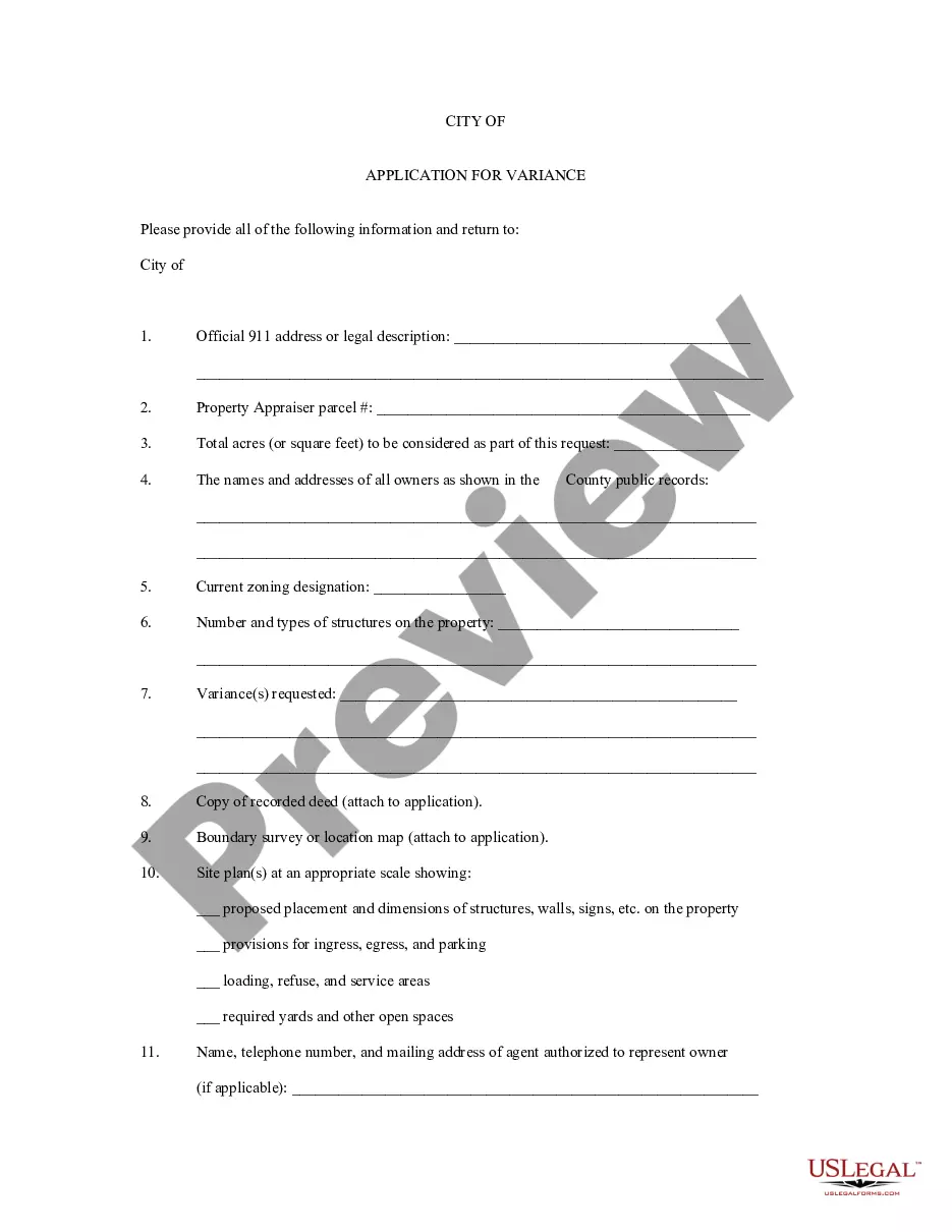
How to fill out Application For Rezoning And / Or Future Land Use Map Amendment?
You are able to devote several hours on the Internet attempting to find the authorized record template that meets the federal and state requirements you will need. US Legal Forms supplies 1000s of authorized forms that are reviewed by experts. You can easily down load or printing the Utah Application for Rezoning and / or Future Land Use Map Amendment from your service.
If you currently have a US Legal Forms accounts, it is possible to log in and then click the Acquire switch. After that, it is possible to total, modify, printing, or signal the Utah Application for Rezoning and / or Future Land Use Map Amendment. Each and every authorized record template you buy is the one you have for a long time. To acquire one more duplicate associated with a purchased kind, visit the My Forms tab and then click the related switch.
If you work with the US Legal Forms website the very first time, follow the simple instructions beneath:
- Initial, be sure that you have chosen the best record template to the state/metropolis of your choice. See the kind outline to make sure you have selected the correct kind. If available, use the Review switch to check through the record template too.
- If you wish to locate one more version in the kind, use the Look for industry to find the template that meets your needs and requirements.
- When you have identified the template you need, just click Purchase now to carry on.
- Pick the rates plan you need, type your accreditations, and sign up for a merchant account on US Legal Forms.
- Full the financial transaction. You can use your bank card or PayPal accounts to pay for the authorized kind.
- Pick the formatting in the record and down load it for your gadget.
- Make alterations for your record if possible. You are able to total, modify and signal and printing Utah Application for Rezoning and / or Future Land Use Map Amendment.
Acquire and printing 1000s of record web templates while using US Legal Forms site, that provides the largest variety of authorized forms. Use expert and condition-distinct web templates to deal with your business or personal requires.
Form popularity
FAQ
"Disability" means a physical or mental impairment that substantially limits one or more of a person's major life activities, including a person having a record of such an impairment or being regarded as having such an impairment.
"Development agreement" means a written agreement or amendment to a written agreement between a municipality and one or more parties that regulates or controls the use or development of a specific area of land. "Development agreement" does not include an improvement completion assurance.
Enactment of land use regulation, land use decision, or development agreement. Only a legislative body, as the body authorized to weigh policy considerations, may enact a land use regulation. Except as provided in Subsection (2)(b), a legislative body may enact a land use regulation only by ordinance.
A development agreement is a voluntary contract between a local jurisdiction and a person who owns or controls property within the jurisdiction, detailing the obligations of both parties and specifying the standards and conditions that will govern development of the property.
The Utah Code is the compilation of the laws of the state passed by the legislature, arranged by subject. Print copies of the Utah Code are available at Utah's law libraries and many public libraries.