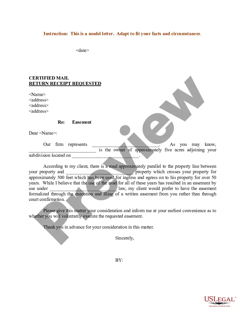
Tennessee Sample Letter regarding Survey Maps
Description
Get your form ready online
Our built-in tools help you complete, sign, share, and store your documents in one place.
Make edits, fill in missing information, and update formatting in US Legal Forms—just like you would in MS Word.
Download a copy, print it, send it by email, or mail it via USPS—whatever works best for your next step.
Sign and collect signatures with our SignNow integration. Send to multiple recipients, set reminders, and more. Go Premium to unlock E-Sign.
If this form requires notarization, complete it online through a secure video call—no need to meet a notary in person or wait for an appointment.
We protect your documents and personal data by following strict security and privacy standards.

Make edits, fill in missing information, and update formatting in US Legal Forms—just like you would in MS Word.

Download a copy, print it, send it by email, or mail it via USPS—whatever works best for your next step.

Sign and collect signatures with our SignNow integration. Send to multiple recipients, set reminders, and more. Go Premium to unlock E-Sign.

If this form requires notarization, complete it online through a secure video call—no need to meet a notary in person or wait for an appointment.

We protect your documents and personal data by following strict security and privacy standards.
Looking for another form?


How to fill out Sample Letter Regarding Survey Maps?
US Legal Forms - among the greatest libraries of authorized forms in America - delivers a variety of authorized papers layouts it is possible to obtain or produce. Using the site, you can find 1000s of forms for organization and person uses, sorted by types, states, or keywords and phrases.You will find the latest models of forms just like the Tennessee Sample Letter regarding Survey Maps in seconds.
If you already have a membership, log in and obtain Tennessee Sample Letter regarding Survey Maps from your US Legal Forms library. The Acquire button can look on each and every form you view. You have access to all previously acquired forms inside the My Forms tab of your respective profile.
If you want to use US Legal Forms initially, allow me to share simple instructions to help you started off:
- Be sure to have selected the correct form to your area/area. Select the Preview button to check the form`s content material. See the form outline to actually have selected the proper form.
- If the form doesn`t suit your requirements, take advantage of the Lookup discipline on top of the monitor to get the one who does.
- In case you are pleased with the shape, verify your choice by clicking on the Get now button. Then, opt for the rates plan you like and provide your references to sign up for an profile.
- Method the purchase. Make use of your charge card or PayPal profile to finish the purchase.
- Select the file format and obtain the shape on your own product.
- Make changes. Complete, modify and produce and indication the acquired Tennessee Sample Letter regarding Survey Maps.
Every web template you added to your bank account does not have an expiry particular date and is your own property forever. So, if you would like obtain or produce another duplicate, just go to the My Forms section and click on about the form you need.
Get access to the Tennessee Sample Letter regarding Survey Maps with US Legal Forms, the most substantial library of authorized papers layouts. Use 1000s of professional and state-certain layouts that meet up with your organization or person requirements and requirements.
Form popularity
FAQ
Applications may be submitted online at onlinelomc/signin, or mail-in forms are available at http:// .fema.gov/change-flood-zone-designation-online- letter-map-change.
A Letter of Map Amendment (LOMA) is an official amendment, by letter, to an effective National Flood Insurance Program (NFIP) map. A LOMA establishes a property's location in relation to the Special Flood Hazard Area (SFHA).
An alternative outcome of the FEMA letter of Map Amendment (LOMA) review process stating that a specific property is located outside the Special Flood Hazard Area (SFHA) as indicated on the Flood Hazard Boundary Map (FHBM) or Flood Insurance Rate Map (FIRM).
A LOMR (Letter Of Map Revision) is a detailed, technical application that is performed and submitted to the local Floodplain Administrator (FPA) and FEMA for review and approval.
FEMA is required to review a community's flood maps every five years. The agency must then decide whether to update or change them. FEMA must also tell Congress every month about any planned changes to community flood maps.