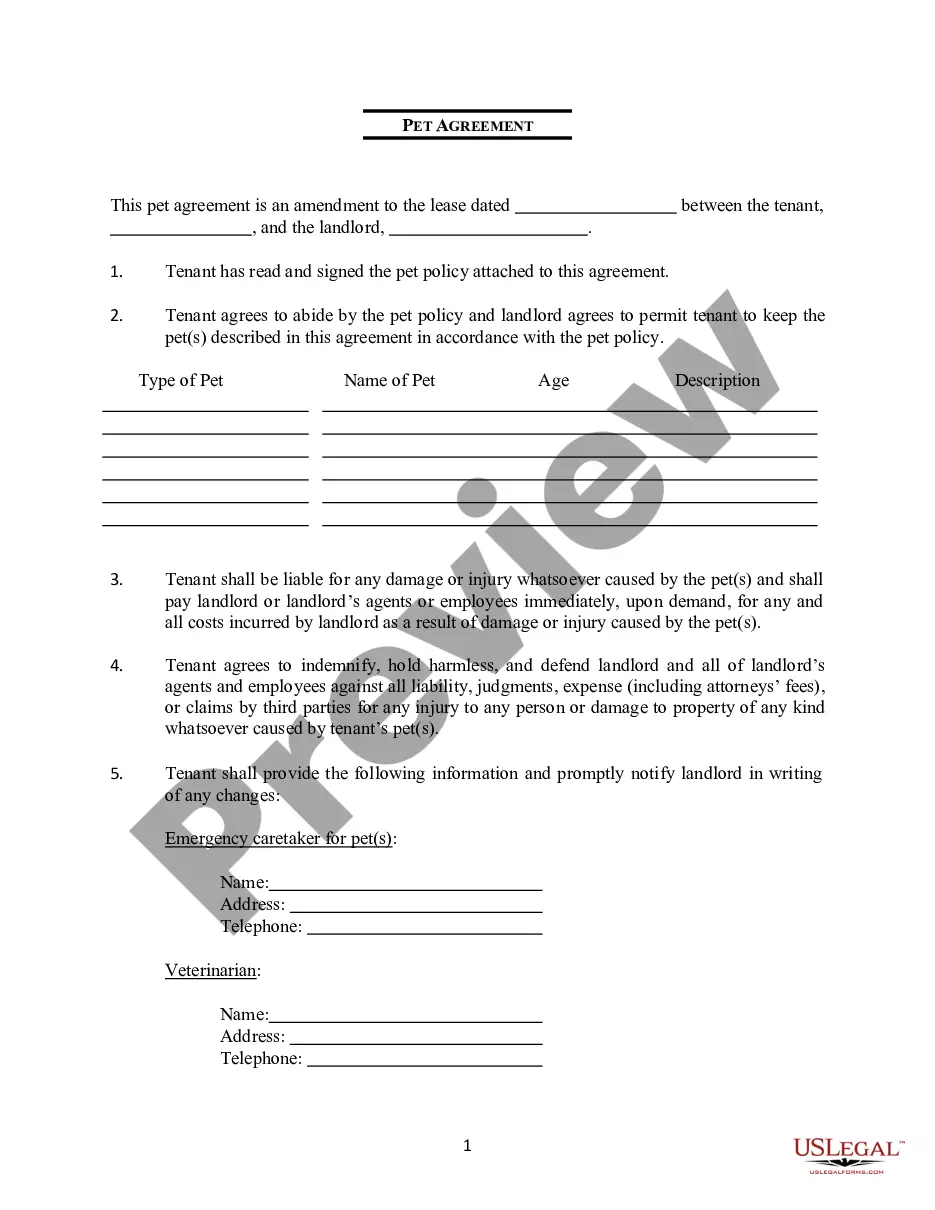
This lease rider form may be used when you are involved in a lease transaction, and have made the decision to utilize the form of Oil and Gas Lease presented to you by the Lessee, and you want to include additional provisions to that Lease form to address specific concerns you may have, or place limitations on the rights granted the Lessee in the “standard” lease form.
New Jersey Survey of Lands included in Producing Or Proration Units
Category:
State:
Multi-State
Control #:
US-OG-831
Format:
Word;
Rich Text
Instant download
Description


How to fill out Survey Of Lands Included In Producing Or Proration Units?
Are you presently in the situation the place you need documents for possibly business or specific reasons virtually every day? There are a variety of authorized record layouts available on the net, but discovering versions you can rely is not effortless. US Legal Forms provides thousands of kind layouts, such as the New Jersey Survey of Lands included in Producing Or Proration Units, which can be composed to meet state and federal specifications.
In case you are presently acquainted with US Legal Forms internet site and possess a merchant account, basically log in. Following that, you are able to download the New Jersey Survey of Lands included in Producing Or Proration Units web template.
If you do not have an bank account and wish to start using US Legal Forms, follow these steps:
- Get the kind you need and ensure it is for that correct city/region.
- Utilize the Preview button to examine the shape.
- Browse the information to ensure that you have selected the correct kind.
- When the kind is not what you`re trying to find, take advantage of the Look for field to discover the kind that meets your requirements and specifications.
- Once you discover the correct kind, click on Purchase now.
- Pick the prices strategy you would like, submit the specified info to produce your money, and buy an order utilizing your PayPal or credit card.
- Pick a hassle-free document format and download your backup.
Find all of the record layouts you might have purchased in the My Forms menus. You can obtain a additional backup of New Jersey Survey of Lands included in Producing Or Proration Units anytime, if required. Just click on the needed kind to download or printing the record web template.
Use US Legal Forms, the most comprehensive selection of authorized kinds, to save lots of time as well as avoid blunders. The services provides skillfully created authorized record layouts that can be used for a variety of reasons. Create a merchant account on US Legal Forms and start creating your life easier.
Form popularity
FAQ
In NJ a land survey can only be done by a licensed Professional Land Surveyor, and it typically costs between $700 and $1000. The land surveyor's job is to locate the boundaries of the land described in the deed. The surveyor examines and records natural and man-made features.
A survey is a graphic description of a property, similar to a map, outlining its legal boundaries, dimensions and other features such as structures, roads, driveways, fences, easements, setbacks, flood zones and elevation. It is typically ordered by your attorney or the title company.
A survey shall show the property lines and or boundary lines on a map prepared by a licensed surveyor. The survey shall show bearing distances and area from previously recorded deeds from the county seat. The map will also include all physical structures ie. House, shed garages pools and fences.
In NJ a land survey can only be done by a licensed Professional Land Surveyor, and it typically costs between $700 and $1000. The land surveyor's job is to locate the boundaries of the land described in the deed. The surveyor examines and records natural and man-made features.
Extensive education, experience, and examination are required for licensure. Specifically, a four-year college degree in Land Surveying, three years of experience in a responsible position, and Examination (16 hours of national examination and 2 hours of New Jersey examination) are required.