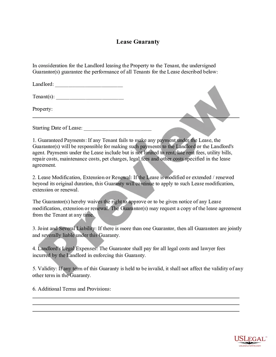
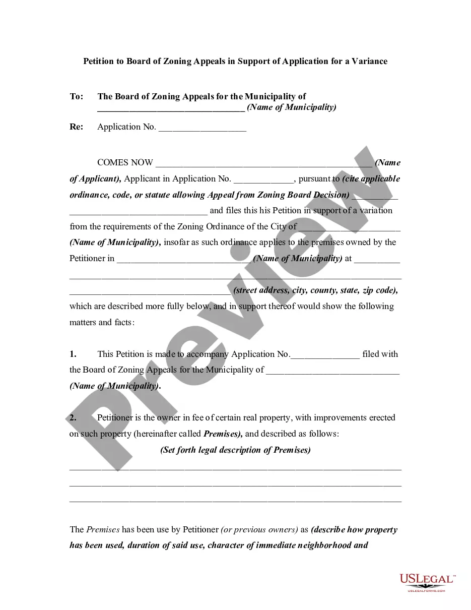
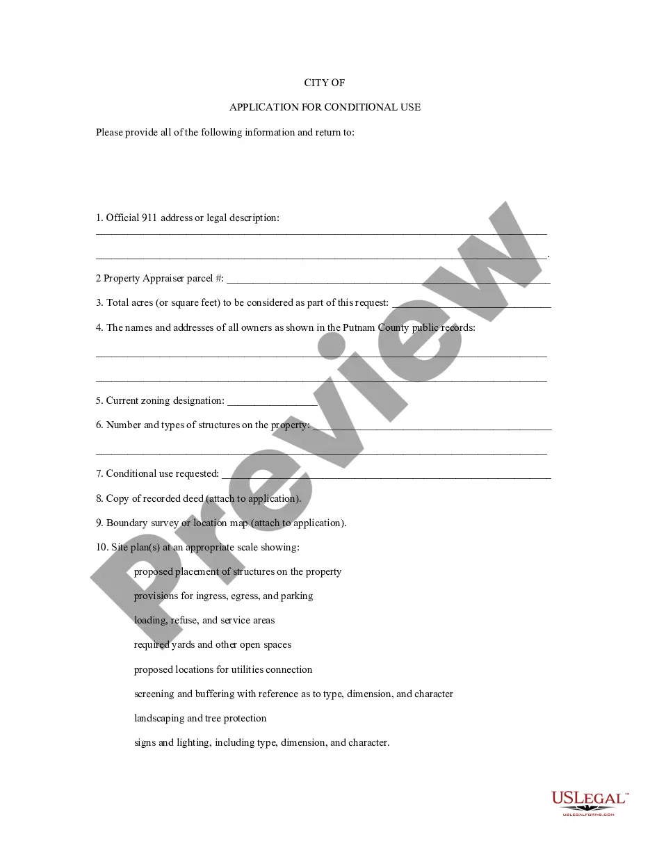
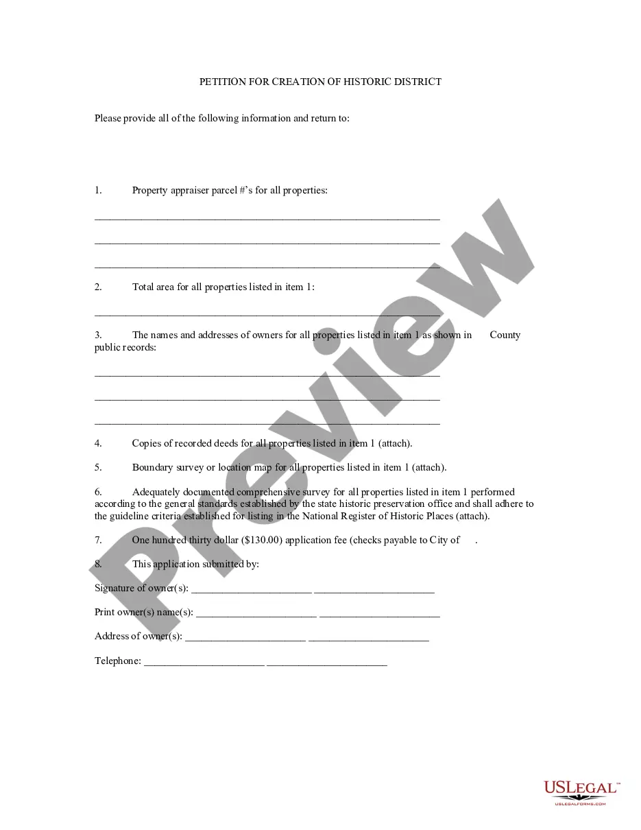
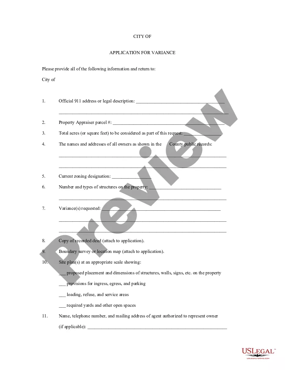
Montana Application for Rezoning and / or Future Land Use Map Amendment
Description


Get your form ready online
Our built-in tools help you complete, sign, share, and store your documents in one place.
Make edits, fill in missing information, and update formatting in US Legal Forms—just like you would in MS Word.
Download a copy, print it, send it by email, or mail it via USPS—whatever works best for your next step.
Sign and collect signatures with our SignNow integration. Send to multiple recipients, set reminders, and more. Go Premium to unlock E-Sign.
If this form requires notarization, complete it online through a secure video call—no need to meet a notary in person or wait for an appointment.
We protect your documents and personal data by following strict security and privacy standards.

Make edits, fill in missing information, and update formatting in US Legal Forms—just like you would in MS Word.

Download a copy, print it, send it by email, or mail it via USPS—whatever works best for your next step.

Sign and collect signatures with our SignNow integration. Send to multiple recipients, set reminders, and more. Go Premium to unlock E-Sign.

If this form requires notarization, complete it online through a secure video call—no need to meet a notary in person or wait for an appointment.

We protect your documents and personal data by following strict security and privacy standards.
Looking for another form?
How to fill out Application For Rezoning And / Or Future Land Use Map Amendment?
If you wish to complete, down load, or print out authorized papers web templates, use US Legal Forms, the greatest selection of authorized kinds, that can be found on the Internet. Take advantage of the site`s simple and easy convenient search to discover the papers you require. Various web templates for organization and specific reasons are sorted by categories and says, or keywords and phrases. Use US Legal Forms to discover the Montana Application for Rezoning and / or Future Land Use Map Amendment within a number of mouse clicks.
In case you are previously a US Legal Forms customer, log in for your profile and then click the Acquire switch to get the Montana Application for Rezoning and / or Future Land Use Map Amendment. You can even access kinds you previously downloaded within the My Forms tab of the profile.
If you work with US Legal Forms the very first time, follow the instructions listed below:
- Step 1. Make sure you have chosen the shape for the correct area/land.
- Step 2. Make use of the Review choice to look over the form`s articles. Do not overlook to read the information.
- Step 3. In case you are unhappy with all the form, make use of the Search industry on top of the screen to find other types in the authorized form web template.
- Step 4. After you have found the shape you require, go through the Acquire now switch. Opt for the costs prepare you favor and add your credentials to sign up for an profile.
- Step 5. Procedure the deal. You may use your Мisa or Ьastercard or PayPal profile to complete the deal.
- Step 6. Choose the structure in the authorized form and down load it on your product.
- Step 7. Complete, modify and print out or signal the Montana Application for Rezoning and / or Future Land Use Map Amendment.
Each authorized papers web template you buy is the one you have for a long time. You possess acces to every single form you downloaded inside your acccount. Click the My Forms portion and choose a form to print out or down load once more.
Compete and down load, and print out the Montana Application for Rezoning and / or Future Land Use Map Amendment with US Legal Forms. There are thousands of professional and condition-certain kinds you can utilize for your personal organization or specific requires.