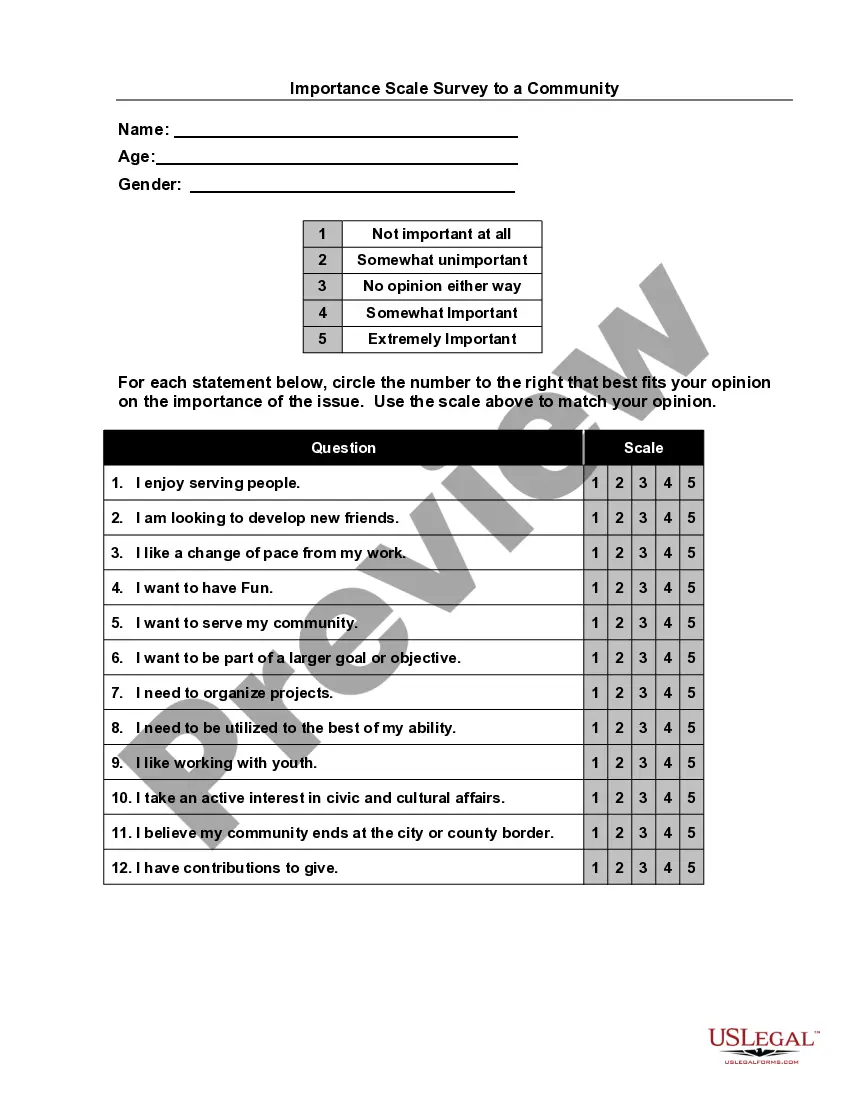
Missouri Importance Scale Survey
Description


Get your form ready online
Our built-in tools help you complete, sign, share, and store your documents in one place.
Make edits, fill in missing information, and update formatting in US Legal Forms—just like you would in MS Word.
Download a copy, print it, send it by email, or mail it via USPS—whatever works best for your next step.
Sign and collect signatures with our SignNow integration. Send to multiple recipients, set reminders, and more. Go Premium to unlock E-Sign.
If this form requires notarization, complete it online through a secure video call—no need to meet a notary in person or wait for an appointment.
We protect your documents and personal data by following strict security and privacy standards.

Make edits, fill in missing information, and update formatting in US Legal Forms—just like you would in MS Word.

Download a copy, print it, send it by email, or mail it via USPS—whatever works best for your next step.

Sign and collect signatures with our SignNow integration. Send to multiple recipients, set reminders, and more. Go Premium to unlock E-Sign.

If this form requires notarization, complete it online through a secure video call—no need to meet a notary in person or wait for an appointment.

We protect your documents and personal data by following strict security and privacy standards.
Looking for another form?
How to fill out Importance Scale Survey?
You have the opportunity to devote time online seeking the sanctioned document format that meets federal and state requirements you will need.
US Legal Forms offers thousands of legal forms that have been evaluated by experts.
You can easily download or print the Missouri Importance Scale Survey from the service.
If available, utilize the Review option to examine the document template as well.
- If you already have a US Legal Forms account, you can Log In and click on the Download button.
- Then, you can fill out, modify, print, or sign the Missouri Importance Scale Survey.
- Every legal document template you receive is yours forever.
- To obtain another copy of an acquired form, visit the My documents section and click the relevant option.
- If you are using the US Legal Forms website for the first time, follow the simple instructions below.
- First, make sure you have chosen the correct document template for the area/city of your preference.
- Check the form description to ensure you have selected the right form.
Form popularity
FAQ
The best way to know how much a survey will cost is to contact a Land Surveyor in your area (like us!) and get a quote. The Average rate for our boundary survey cost in St. Louis or St Charles areas are typically between $375-$750 for ¼ acre lots.
A property survey confirms a property's boundary lines and legal description. It also determines other restrictions or easements included in the property. While you can technically get your property surveyed at any time, confirming the boundaries of your land is an important part of the home buying process.
Geodetic Surveying is used for getting control points for horizontal control. Geodetic Survey: The surveys in which the curvature of the earth is taken into consideration are known as geodetic surveying. All lines lying on the surface are curved lines and the triangles are spherical triangles.
Survey pins are typically 15 feet in from the curb. Go to your front curb and measure back about 15 feet in the area you think your marker should be. Use a metal detector and then start digging. The marker should be about 6-10 inches below the surface.
The Average rate for our boundary survey cost in St. Louis or St Charles areas are typically between $375-$750 for ¼ acre lots. There are many factors that can contribute to the increase of a property line survey cost that you should consider: Lot size.
Survey documents are stored in the Land Records Repository and are available to municipalities, land surveyors, other professionals and the public.
Geodetic Engineering deals with the collection and measurement of spatial data using technologies and instruments. This program prepares future geodetic engineers to process and manage geographical data to produce maps, plans, charts, and other spatial information systems.
Geodetic surveys are required for large scale projects where the effects of the earth curvature are critical or when a high degree of accuracy in necessary to complete the particular project. Surveying with the global positioning system (GPS) requires the surveyor to think in a geodetic surveying mode.
A geodetic survey determines the precise position of permanent points on the earth's surface, taking into account the shape, size and curvature of the earth.
A land survey, or simply survey, is the scientific process of measuring the dimensions of a particular area of the earth's surface, including its horizontal distances, directions, angles, and elevations. Artificial structures, such as a road or building, may also be noted on a survey.