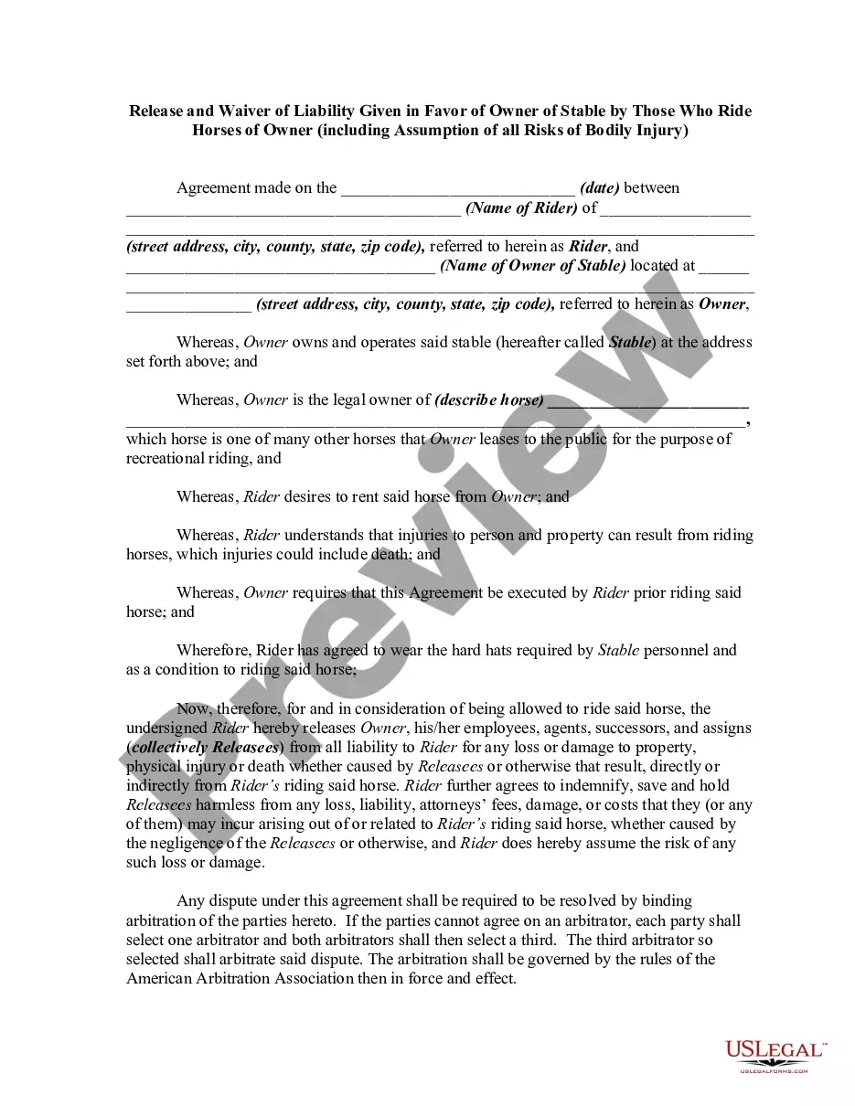
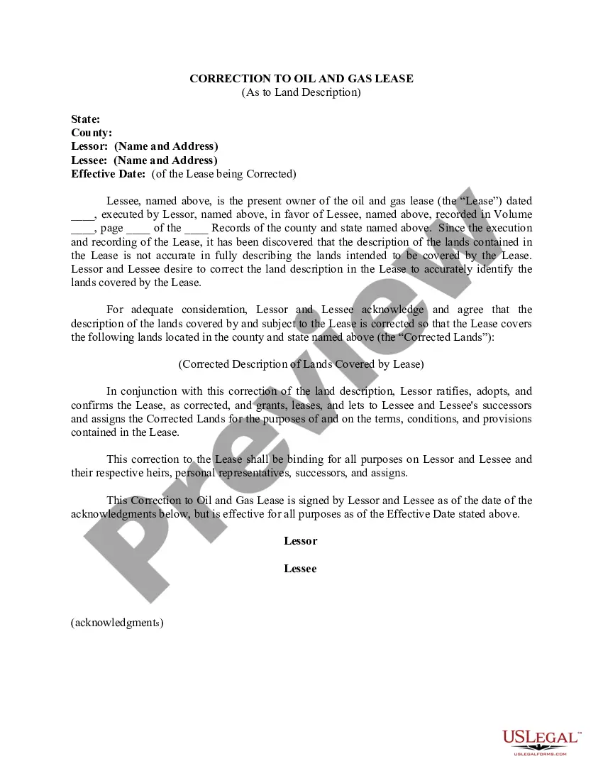
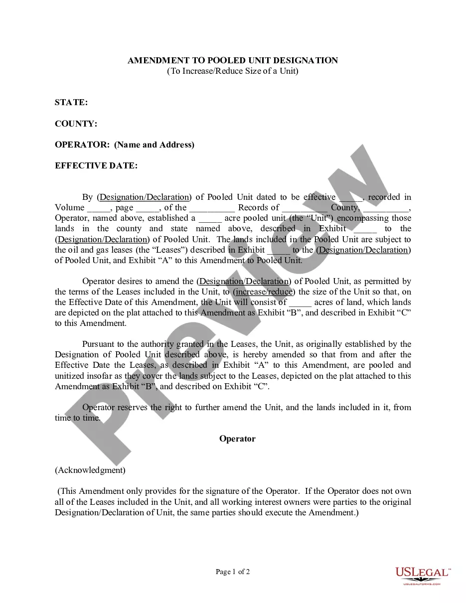
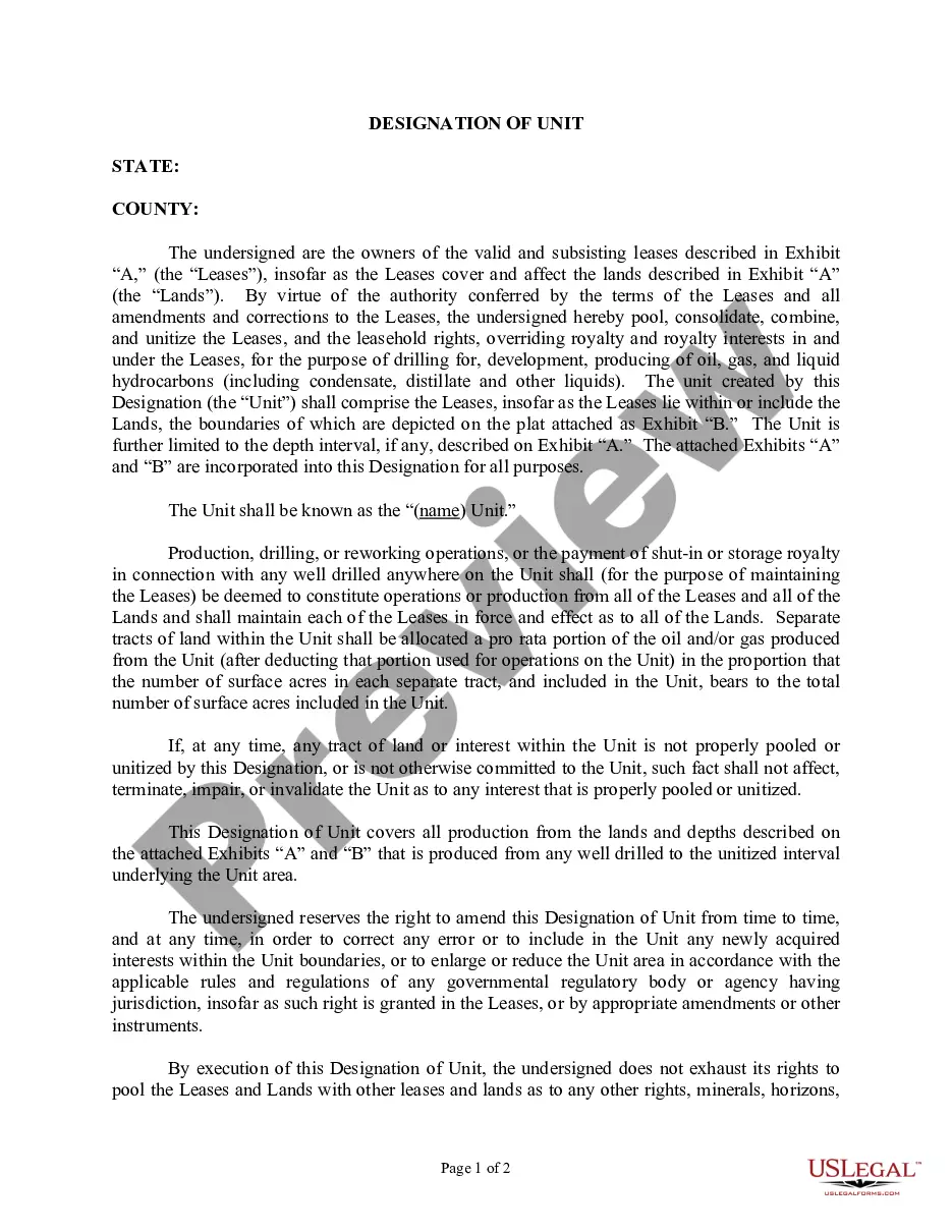
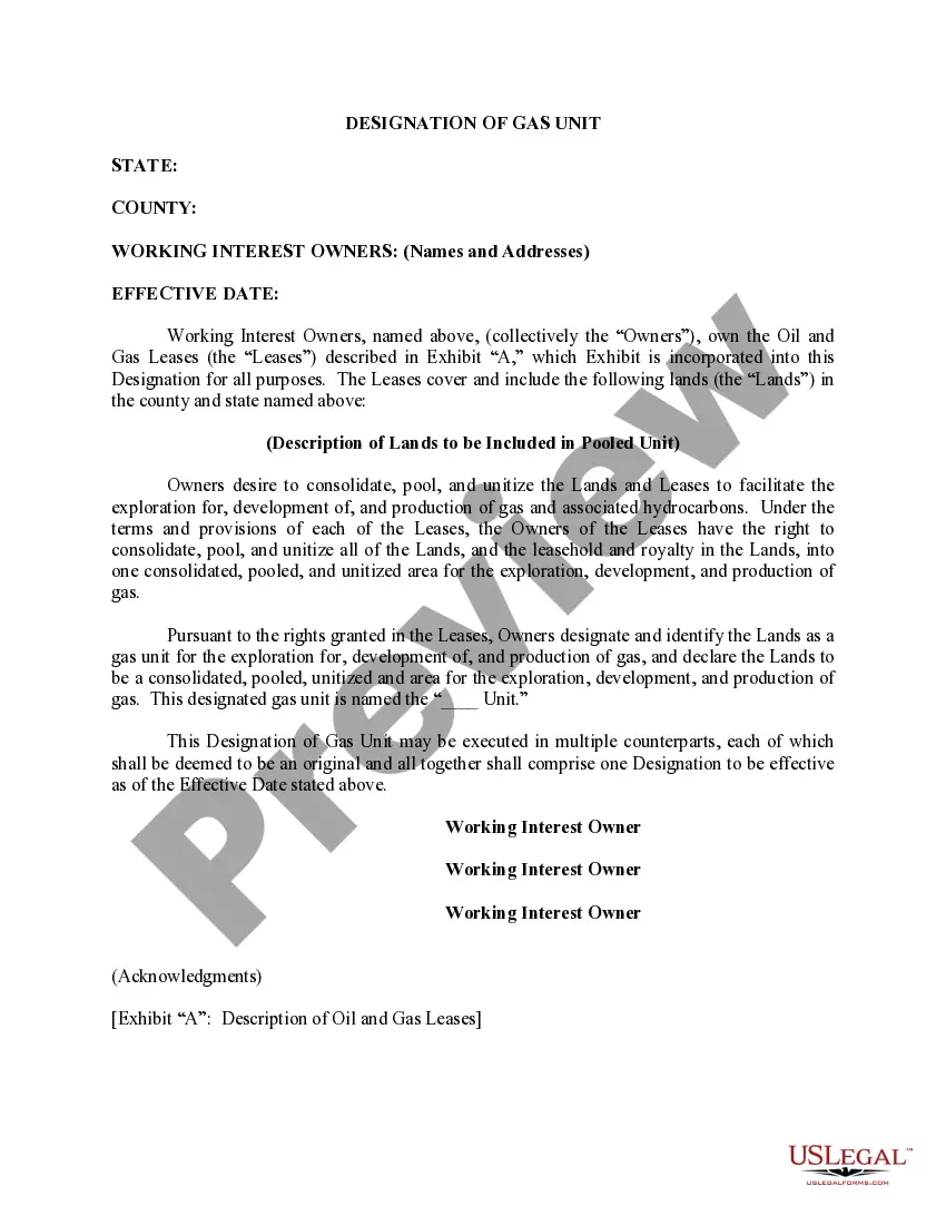
California Correction to Unit Designation to Correct Depth
Description

Get your form ready online
Our built-in tools help you complete, sign, share, and store your documents in one place.
Make edits, fill in missing information, and update formatting in US Legal Forms—just like you would in MS Word.
Download a copy, print it, send it by email, or mail it via USPS—whatever works best for your next step.
Sign and collect signatures with our SignNow integration. Send to multiple recipients, set reminders, and more. Go Premium to unlock E-Sign.
If this form requires notarization, complete it online through a secure video call—no need to meet a notary in person or wait for an appointment.
We protect your documents and personal data by following strict security and privacy standards.

Make edits, fill in missing information, and update formatting in US Legal Forms—just like you would in MS Word.

Download a copy, print it, send it by email, or mail it via USPS—whatever works best for your next step.

Sign and collect signatures with our SignNow integration. Send to multiple recipients, set reminders, and more. Go Premium to unlock E-Sign.

If this form requires notarization, complete it online through a secure video call—no need to meet a notary in person or wait for an appointment.

We protect your documents and personal data by following strict security and privacy standards.
Looking for another form?
How to fill out Correction To Unit Designation To Correct Depth?
You can devote several hours on the web looking for the lawful document design that meets the state and federal demands you will need. US Legal Forms supplies 1000s of lawful forms which are evaluated by professionals. You can easily down load or print out the California Correction to Unit Designation to Correct Depth from the support.
If you already possess a US Legal Forms accounts, you are able to log in and click the Down load switch. Next, you are able to complete, edit, print out, or sign the California Correction to Unit Designation to Correct Depth. Every lawful document design you buy is yours forever. To get an additional backup of any purchased develop, visit the My Forms tab and click the corresponding switch.
Should you use the US Legal Forms internet site the first time, keep to the easy directions under:
- Initially, be sure that you have selected the correct document design for your region/city of your liking. Look at the develop information to make sure you have picked out the appropriate develop. If available, use the Preview switch to appear with the document design at the same time.
- If you wish to find an additional version in the develop, use the Search industry to get the design that meets your requirements and demands.
- Upon having found the design you would like, just click Acquire now to continue.
- Pick the pricing program you would like, key in your credentials, and sign up for an account on US Legal Forms.
- Complete the financial transaction. You may use your credit card or PayPal accounts to fund the lawful develop.
- Pick the structure in the document and down load it to your product.
- Make adjustments to your document if required. You can complete, edit and sign and print out California Correction to Unit Designation to Correct Depth.
Down load and print out 1000s of document layouts using the US Legal Forms web site, which provides the greatest collection of lawful forms. Use professional and status-distinct layouts to tackle your small business or personal demands.