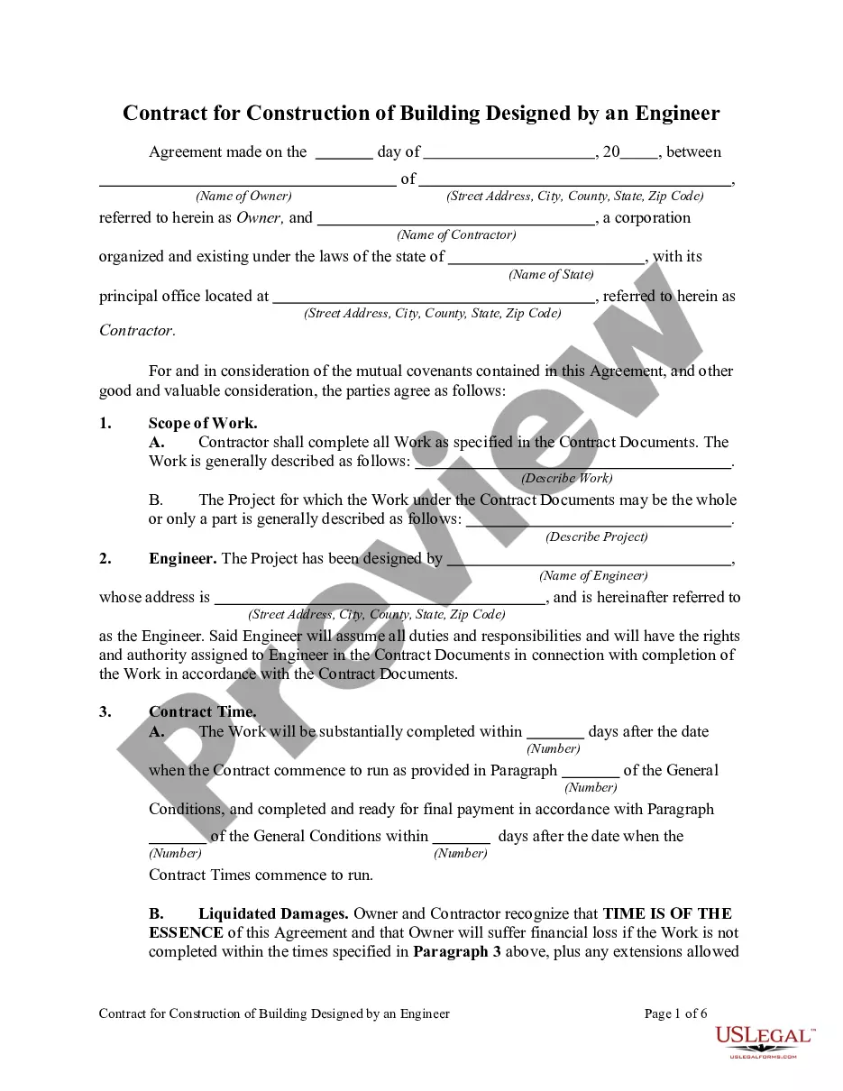
Tennessee Geophysical Permit
Description


Get your form ready online
Our built-in tools help you complete, sign, share, and store your documents in one place.
Make edits, fill in missing information, and update formatting in US Legal Forms—just like you would in MS Word.
Download a copy, print it, send it by email, or mail it via USPS—whatever works best for your next step.
Sign and collect signatures with our SignNow integration. Send to multiple recipients, set reminders, and more. Go Premium to unlock E-Sign.
If this form requires notarization, complete it online through a secure video call—no need to meet a notary in person or wait for an appointment.
We protect your documents and personal data by following strict security and privacy standards.

Make edits, fill in missing information, and update formatting in US Legal Forms—just like you would in MS Word.

Download a copy, print it, send it by email, or mail it via USPS—whatever works best for your next step.

Sign and collect signatures with our SignNow integration. Send to multiple recipients, set reminders, and more. Go Premium to unlock E-Sign.

If this form requires notarization, complete it online through a secure video call—no need to meet a notary in person or wait for an appointment.

We protect your documents and personal data by following strict security and privacy standards.
Looking for another form?
How to fill out Geophysical Permit?
You may commit hours on the web looking for the legal file template which fits the federal and state demands you will need. US Legal Forms supplies 1000s of legal kinds which are reviewed by specialists. It is possible to down load or print out the Tennessee Geophysical Permit from your service.
If you already possess a US Legal Forms profile, you may log in and click on the Obtain switch. Afterward, you may total, modify, print out, or signal the Tennessee Geophysical Permit. Each legal file template you buy is your own permanently. To acquire an additional backup associated with a purchased form, proceed to the My Forms tab and click on the related switch.
If you use the US Legal Forms web site the very first time, adhere to the simple directions under:
- First, make sure that you have chosen the right file template to the county/metropolis that you pick. Browse the form description to ensure you have picked the correct form. If offered, use the Review switch to appear through the file template also.
- If you want to locate an additional model of the form, use the Search area to get the template that meets your requirements and demands.
- Once you have located the template you need, click Buy now to carry on.
- Pick the rates prepare you need, key in your accreditations, and register for a merchant account on US Legal Forms.
- Comprehensive the deal. You may use your credit card or PayPal profile to fund the legal form.
- Pick the file format of the file and down load it in your product.
- Make modifications in your file if required. You may total, modify and signal and print out Tennessee Geophysical Permit.
Obtain and print out 1000s of file layouts using the US Legal Forms Internet site, which offers the greatest collection of legal kinds. Use professional and express-distinct layouts to tackle your small business or specific requires.
Form popularity
FAQ
Geophysical data is used to provide information on the physical properties of the Earth's surface and subsurface. As a result, geophysical data can help locate hydrocarbons, minerals, aggregate, and other natural resources. Uses for Geophysical Data alaska.gov ? geophysics ? uses alaska.gov ? geophysics ? uses
For a Learner Permit or Intermediate Driver License you will need to bring: Proof of U.S. Citizenship, Lawful Permanent Resident Status or Proof of authorized stay in the United States. Primary Proof of Identity. Secondary Proof of Identity. Proof of any Name Changes if Different than name on Primary ID.
New installer applicants must contact their local Environmental Field Office to answer any questions and to discuss testing schedules. Applicants will need to complete an "Application for Subsurface Sewage Disposal System Installer Permit" (above) and provide the associated permit fee upon successful testing.
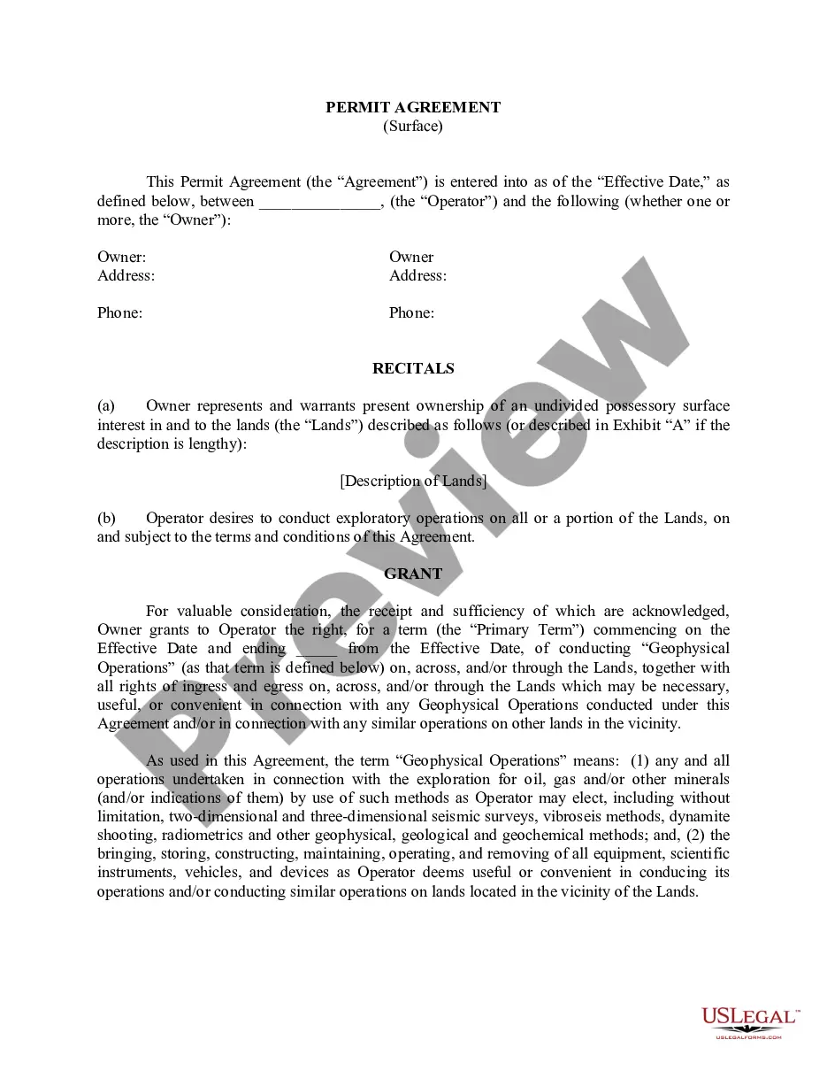
General Offshore Geophysical Survey Permit This nonexclusive permit authorizes geophysical survey activity during the permit term. A General Offshore Geophysical Survey Permit is required for geophysical surveys utilizing low-energy equipment conducted in marine waters under the jurisdiction of the Commission.
Geophysical surveys are completed for a variety of reasons, from archaeological purposes to geological and mining. Archeologists will use geophysical surveys such as ground-penetrating radar (GPR) and magnetometers to identify subsurface artifacts such as underwater shipwrecks or underground burials. What Are Geophysical Surveys & Why Do They Matter rangefront.com ? blog ? what-are-geophysic... rangefront.com ? blog ? what-are-geophysic...
A detailed review of the application is conducted, and the applicant is notified when the review is complete. The review process generally takes 10 days and must be completed within 45 days of the date the application was submitted.