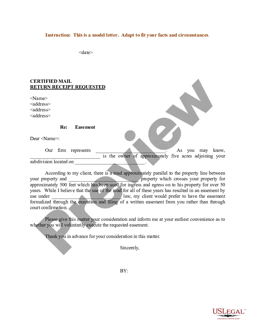
Kansas Sample Letter regarding Survey Maps
Description
Get your form ready online
Our built-in tools help you complete, sign, share, and store your documents in one place.
Make edits, fill in missing information, and update formatting in US Legal Forms—just like you would in MS Word.
Download a copy, print it, send it by email, or mail it via USPS—whatever works best for your next step.
Sign and collect signatures with our SignNow integration. Send to multiple recipients, set reminders, and more. Go Premium to unlock E-Sign.
If this form requires notarization, complete it online through a secure video call—no need to meet a notary in person or wait for an appointment.
We protect your documents and personal data by following strict security and privacy standards.

Make edits, fill in missing information, and update formatting in US Legal Forms—just like you would in MS Word.

Download a copy, print it, send it by email, or mail it via USPS—whatever works best for your next step.

Sign and collect signatures with our SignNow integration. Send to multiple recipients, set reminders, and more. Go Premium to unlock E-Sign.

If this form requires notarization, complete it online through a secure video call—no need to meet a notary in person or wait for an appointment.

We protect your documents and personal data by following strict security and privacy standards.
Looking for another form?
How to fill out Sample Letter Regarding Survey Maps?
US Legal Forms - one of many biggest libraries of legal types in the USA - delivers a wide range of legal file layouts you can acquire or print out. Using the internet site, you will get a huge number of types for company and person purposes, sorted by groups, claims, or keywords.You can get the most recent types of types such as the Kansas Sample Letter regarding Survey Maps in seconds.
If you already possess a membership, log in and acquire Kansas Sample Letter regarding Survey Maps from your US Legal Forms collection. The Download button will appear on every single form you see. You get access to all previously saved types in the My Forms tab of your own profile.
In order to use US Legal Forms the first time, here are straightforward directions to help you started off:
- Make sure you have picked out the proper form for the metropolis/county. Click on the Preview button to analyze the form`s content material. Browse the form information to ensure that you have selected the proper form.
- In case the form does not match your needs, use the Search area at the top of the monitor to discover the the one that does.
- If you are happy with the form, affirm your decision by clicking the Purchase now button. Then, opt for the prices prepare you like and provide your references to sign up for the profile.
- Approach the purchase. Make use of credit card or PayPal profile to accomplish the purchase.
- Find the formatting and acquire the form on your own product.
- Make adjustments. Load, edit and print out and indication the saved Kansas Sample Letter regarding Survey Maps.
Every design you included in your money lacks an expiry day and is your own forever. So, if you want to acquire or print out another version, just go to the My Forms section and click on the form you require.
Obtain access to the Kansas Sample Letter regarding Survey Maps with US Legal Forms, the most comprehensive collection of legal file layouts. Use a huge number of expert and condition-certain layouts that meet up with your small business or person requirements and needs.
Form popularity
FAQ
A Letter of Map Amendment (LOMA) is an official amendment, by letter, to an effective National Flood Insurance Program (NFIP) map. A LOMA establishes a property's location in relation to the Special Flood Hazard Area (SFHA).
Letters of Map Amendment (LOMA), Letters of Map Revision (LOMR) and Letters of Map Revision Based on Fill (LOMR-F) are documents issued by FEMA that officially remove a property and/or structure from the floodplain for flood insurance purposes.
Letter of Map Revision Based on Fill (LOMR-F): A letter from FEMA stating that an existing structure or parcel of land has been elevated by earthen fill and would not be inundated by the base flood.
A LOMA is a Letter of Map Amendment. It is a document from FEMA which states that while a structure, or portion of property, is mapped within the flood zone; it is not at risk for flooding based on the elevation of the structure, or portion of the property.
A Letter of Map Revision (LOMR) is the Federal Emergency Management Agency's (FEMA's) official modification to an effective Flood Insurance Rate Map (FIRM). LOMRs can result in a physical change to the existing regulatory floodway, the effective Base Flood Elevations (BFEs), or the Special Flood Hazard Area (SFHA).
A Letter of Map Revision is FEMA's modification to an effective Flood Insurance Rate Map (FIRM), or Flood Boundary and Floodway Map (FBFM), or both.
Letters of Map Change (LMOC) This process will start a formal determination of your property's location and elevation relative to a SFHA. FEMA generally does not revise a map that is currently effective.
LOMA ? A Letter of Map Amendment (LOMA) is an official amendment, by letter, to an effective NFIP map. A LOMA establishes a property's location in relation to the SFHA. LOMR ? A Letter of Map Revision (LOMR) is an official revision, by letter, to an effective NFIP map.