Loading

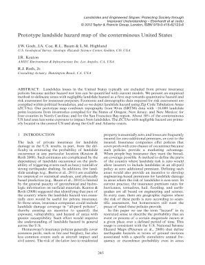
Get Prototype Landslide Hazard Map Of The Conterminous United States - Profile Usgs
How it works
-
Open form follow the instructions
-
Easily sign the form with your finger
-
Send filled & signed form or save
How to fill out the Prototype Landslide Hazard Map Of The Conterminous United States - Profile Usgs online
This guide provides a detailed, step-by-step approach to filling out the Prototype Landslide Hazard Map Of The Conterminous United States - Profile Usgs form online. By understanding the sections and fields within the form, users can ensure that they accurately complete the necessary information.
Follow the steps to properly complete the form online.
- Click ‘Get Form’ button to obtain the Prototype Landslide Hazard Map Of The Conterminous United States - Profile Usgs and open it in the digital editor.
- Begin filling out the form by providing the requested identification details, such as your name, contact information, and any relevant affiliation.
- Next, proceed to the section that outlines the geographic area of interest. Specify the Zip Code Tabulation Areas (ZCTAs) you are focusing on, as these will determine the relevant landslide hazard data.
- In the subsequent section, indicate any relevant topographic data, including slope and relief information. This data can typically be sourced from the online resources or databases related to landslide hazards.
- Review the landslide point locations that apply to your selected areas. Each ZCTA will have a set of identified landslide point data that should be verified against your input.
- After completing all necessary sections, ensure that all information is accurate and complete. Utilize any available validation tools provided in the form to check for errors.
- Finalize the process by saving your changes. You can then download, print, or share the completed Prototype Landslide Hazard Map Of The Conterminous United States - Profile Usgs form as needed.
Complete the Prototype Landslide Hazard Map Of The Conterminous United States - Profile Usgs form online to assess and understand landslide hazards effectively.
Landslide monitoring involves the usage of a durable prediction and forewarning system, coupled with effective efforts to curb the slope movement. The destruction can be drastically reduced with the help of monitoring and instrumentation.
Industry-leading security and compliance
US Legal Forms protects your data by complying with industry-specific security standards.
-
In businnes since 199725+ years providing professional legal documents.
-
Accredited businessGuarantees that a business meets BBB accreditation standards in the US and Canada.
-
Secured by BraintreeValidated Level 1 PCI DSS compliant payment gateway that accepts most major credit and debit card brands from across the globe.


