We use cookies to improve security, personalize the user experience, enhance our marketing activities (including cooperating with our marketing partners) and for other business use.
Click "here" to read our Cookie Policy. By clicking "Accept" you agree to the use of cookies. Read less
Read more
Accept
Loading
Form preview
  • US Legal Forms
  • Form Library
  • More Forms
  • More Multi-State Forms
  • Open Geospatial Consortium, Inc. Opengis Web Map Service

Get Open Geospatial Consortium, Inc. Opengis Web Map Service

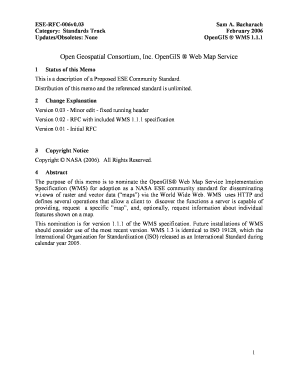
Is Memo This is a description of a Proposed ESE Community Standard. Distribution of this memo and the referenced standard is unlimited. 2 Change Explanation Version 0.03 - Minor edit - fixed running header Version 0.02 - RFC with included WMS 1.1.1 specification Version 0.01 - Initial RFC 3 Copyright Notice Copyright NASA (2006). All Rights Reserved. 4 Abstract The purpose of this memo is to nominate the OpenGIS Web Map Service Implementation Specification (WMS) for adoption as a NA.

How it works

  1. Open form

    Open form follow the instructions

  2. Easily sign form

    Easily sign the form with your finger

  3. Share form

    Send filled & signed form or save

Tips on how to fill out, edit and sign Open Geospatial Consortium, Inc. OpenGIS Web Map Service online

How to fill out and sign Open Geospatial Consortium, Inc. OpenGIS Web Map Service online?

Get your online template and fill it in using progressive features. Enjoy smart fillable fields and interactivity. Follow the simple instructions below:

Feel all the key benefits of submitting and completing legal documents online. With our platform completing Open Geospatial Consortium, Inc. OpenGIS Web Map Service usually takes a couple of minutes. We make that possible through giving you access to our full-fledged editor effective at transforming/correcting a document?s original text, inserting unique boxes, and e-signing.

Execute Open Geospatial Consortium, Inc. OpenGIS Web Map Service in just several clicks by following the instructions below:

  1. Select the template you want from our collection of legal form samples.
  2. Select the Get form key to open the document and move to editing.
  3. Complete all the required boxes (these are yellowish).
  4. The Signature Wizard will allow you to insert your electronic signature right after you have finished imputing data.
  5. Insert the date.
  6. Check the whole document to be certain you?ve filled out all the information and no changes are required.
  7. Hit Done and save the resulting template to your computer.

Send your Open Geospatial Consortium, Inc. OpenGIS Web Map Service in a digital form when you finish filling it out. Your information is well-protected, because we keep to the latest security criteria. Join millions of satisfied users that are already filling out legal forms right from their homes.

How to edit Open Geospatial Consortium, Inc. OpenGIS Web Map Service: customize forms online

Put the right document management capabilities at your fingertips. Complete Open Geospatial Consortium, Inc. OpenGIS Web Map Service with our reliable tool that comes with editing and eSignature functionality}.

If you want to execute and certify Open Geospatial Consortium, Inc. OpenGIS Web Map Service online without hassle, then our online cloud-based solution is the way to go. We provide a rich template-based library of ready-to-use forms you can modify and fill out online. Furthermore, you don't need to print out the form or use third-party options to make it fillable. All the needed tools will be readily available at your disposal as soon as you open the file in the editor.

Let’s examine our online editing capabilities and their key functions. The editor features a intuitive interface, so it won't require much time to learn how to use it. We’ll take a look at three main sections that let you:

  • Edit and annotate the template
  • The top toolbar has the tools that help you highlight and blackout text, without graphics and graphic elements (lines, arrows and checkmarks etc.), add your signature to, initialize, date the document, and more.

  • Organize your paperwork
  • Use the toolbar on the left if you wish to re-order the document or/and remove pages.

  • Make them shareable
  • If you want to make the template fillable for others and share it, you can use the tools on the right and insert different fillable fields, signature and date, text box, etc.).

Aside from the capabilities mentioned above, you can protect your file with a password, add a watermark, convert the document to the required format, and much more.

Our editor makes modifying and certifying the Open Geospatial Consortium, Inc. OpenGIS Web Map Service a breeze. It allows you to make basically everything when it comes to working with forms. Moreover, we always ensure that your experience working with documents is secure and compliant with the main regulatory criteria. All these factors make using our tool even more enjoyable.

Get Open Geospatial Consortium, Inc. OpenGIS Web Map Service, apply the needed edits and tweaks, and get it in the desired file format. Try it out today!

Get form

Experience a faster way to fill out and sign forms on the web. Access the most extensive library of templates available.
Get form

Related content

Open Geospatial Consortium, Inc. OpenGIS ® Web...
The purpose of this memo is to nominate the OpenGIS® Web Map Service Implementation...
Learn more
OGC WMS 1.1.0 Implementation Specification
A standard web browser can ask a Web Map Service to perform these operations simply by...
Learn more
Open Geospatial Consortium - frwiki.wiki
Open Geospatial Consortium , lub OGC , jest międzynarodowym konsorcjum w celu opracowania...
Learn more

Related links form

Chemistry 120 Supplemental Lab Manual AV Equipment Install For Lloyd Hall - Purchasing Ua TC 6 Form Registration Brochure - University Of Alabama At Birmingham

Questions & Answers

Get answers to your most pressing questions about US Legal Forms API.

Contact support

The WMS specification of the Open Geospatial Consortium defines how clients can request geospatial data via standard web services. This specification ensures that maps are generated in a consistent format, making it easier for applications to display data from different sources. Adopting the Open Geospatial Consortium, Inc. OpenGIS Web Map Service allows organizations to ensure their data adheres to these established standards.

WMS, or Web Map Service, is a standard developed by the Open Geospatial Consortium that allows users to request and display geospatial data over the internet. This service delivers maps and related information, making it easier for users to visualize complex data layers. Utilizing the Open Geospatial Consortium, Inc. OpenGIS Web Map Service, organizations can efficiently share and access dynamic maps tailored to their needs.

The OpenGIS specification outlines the technical standards for geospatial data and services established by the Open Geospatial Consortium. It serves as a foundation for interoperability between different systems and applications. By adhering to these specifications, users can benefit from the Open Geospatial Consortium, Inc. OpenGIS Web Map Service to ensure seamless integration of geospatial resources.

Members of the Open Geospatial Consortium include diverse organizations, ranging from government agencies to private companies and academic institutions. These members collaborate to create and promote open standards for geospatial data and services. By joining the Open Geospatial Consortium, Inc. OpenGIS Web Map Service, organizations can leverage these standards to enhance their geospatial capabilities.

The open GIS standard comprises guidelines established by the Open Geospatial Consortium to ensure that geographic information systems operate with consistency and openness. These standards enable various software and applications to work together seamlessly, improving data sharing and usability. Implementing these standards assists businesses in developing robust geospatial solutions.

To add a Web map service in ArcGIS Pro, you can start by selecting the 'Add Data' option from the toolbar. Then, choose 'Data from Path' and enter the URL of the OpenGIS Web Map Service you wish to use. This process allows you to seamlessly integrate live maps and geospatial data into your projects, enhancing your mapping capabilities.

To map geospatial data effectively, you should first collect and organize the relevant data in a compatible format. Using tools such as the OpenGIS Web Map Service can streamline this process, allowing users to render maps directly from geospatial data sources. Once your data is structured, you can utilize software like ArcGIS or QGIS to visualize and analyze this information.

Geospatial open data refers to publicly available information that has a geographic aspect and can be freely used, modified, and shared by anyone. The Open Geospatial Consortium, Inc. emphasizes the importance of such data in promoting transparency and informed decision-making. This open data can include maps, satellite imagery, and other spatial information that supports various applications.

The WMS GetCapabilities request returns a document in XML format, which provides detailed information about a web map service. This document includes the service's offerings, supported operations, and available data layers. By leveraging the Open Geospatial Consortium, Inc. OpenGIS Web Map Service, users can quickly gather the necessary details to use the WMS effectively.

WMS geospatial data is typically transmitted in formats such as Scalable Vector Graphics (SVG), GeoTIFF, or PNG for map images. These formats are designed to be lightweight and easily loadable over the web, promoting faster access to geospatial information. The Open Geospatial Consortium, Inc. OpenGIS Web Map Service specifies these formats to facilitate broader adoption.

Get This Form Now!

Use professional pre-built templates to fill in and sign documents online faster. Get access to thousands of forms.
Get form
If you believe that this page should be taken down, please follow our DMCA take down processhere.

Industry-leading security and compliance

US Legal Forms protects your data by complying with industry-specific security standards.
  • In businnes since 1997
    25+ years providing professional legal documents.
  • Accredited business
    Guarantees that a business meets BBB accreditation standards in the US and Canada.
  • Secured by Braintree
    Validated Level 1 PCI DSS compliant payment gateway that accepts most major credit and debit card brands from across the globe.
Get Open Geospatial Consortium, Inc. OpenGIS Web Map Service
Get form
Form Packages
Adoption
Bankruptcy
Contractors
Divorce
Home Sales
Employment
Identity Theft
Incorporation
Landlord Tenant
Living Trust
Name Change
Personal Planning
Small Business
Wills & Estates
Packages A-Z
Form Categories
Affidavits
Bankruptcy
Bill of Sale
Corporate - LLC
Divorce
Employment
Identity Theft
Internet Technology
Landlord Tenant
Living Wills
Name Change
Power of Attorney
Real Estate
Small Estates
Wills
All Forms
Forms A-Z
Form Library
Customer Service
Terms of Service
DMCA Policy
About Us
Blog
Affiliates
Contact Us
Privacy Notice
Delete My Account
Site Map
All Forms
Search all Forms
Industries
Forms in Spanish
Localized Forms
Legal Guides
Real Estate Handbook
All Guides
Prepared for You
Notarize
Incorporation services
Our Customers
For Consumers
For Small Business
For Attorneys
Our Sites
US Legal Forms
USLegal
FormsPass
pdfFiller
signNow
airSlate workflows
DocHub
Instapage
Social Media
Call us now toll free:
1-877-389-0141
As seen in:
  • USA Today logo picture
  • CBC News logo picture
  • LA Times logo picture
  • The Washington Post logo picture
  • AP logo picture
  • Forbes logo picture
© Copyright 1997-2025
airSlate Legal Forms, Inc.
3720 Flowood Dr, Flowood, Mississippi 39232