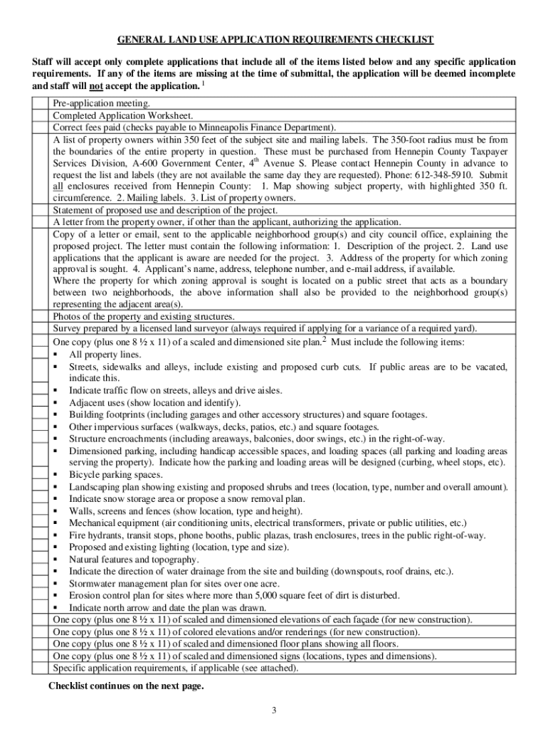
S application packet is used to file any land use application(s) that requires approval by the Minneapolis City Planning Commission or the Zoning Board of Adjustment. The packet is a tool for gathering property-related information relevant to a land use application. It contains a checklist of materials required for a land use application and a worksheet to be completed by the applicant. The Minneapolis Zoning Code (Chapter 525, Section 140) governs the land use application process. 525.140. Appl.

Open form follow the instructions

Easily sign the form with your finger

Send filled & signed form or save
How to fill out the MN General Land Use Application online
Completing the MN General Land Use Application online can seem daunting, but with clear guidance, you can successfully navigate through each section. This guide will provide you with step-by-step instructions to ensure your application is accurate and complete.
Follow the steps to fill out the application successfully.
- Click ‘Get Form’ button to obtain the form and open it in the editor.
- Begin by filling out the property owner/applicant information. Include the name, mailing address, phone number, and email. Ensure that the information is correct to avoid any delays.
- Provide details for the applicant’s representative if applicable. This is the individual who will serve as the primary contact for staff.
- Enter the neighborhood group contact information, including the organization name, contact person, and date the notification was sent.
- Fill in the property information. This includes the property address, identification numbers, legal description, lot area, and zoning classifications.
- Specify the name of the proposed project, if there is one, along with the existing business information, including gross floor area and current use.
- Detail the proposed changes to the building’s height and footprint, including specific measurements for existing and proposed structures.
- Complete the parking data section, outlining the number of existing and proposed spaces, including standard, compact, handicap, and bicycle spaces.
- Fill out the landscaping data by indicating the landscaped area and impervious surfaces. Make sure to provide details for both existing and proposed conditions.
- Collect any required documents listed in the requirements checklist, including a site plan, fee payment, and any correspondence sent to the neighborhood group and council member.
- Review the application thoroughly to ensure all areas are filled out accurately. Incomplete applications will be deemed unprocessable.
- Once all sections are complete, users can save their changes, download the form, print it, or share it as necessary.
Start your online application process now to ensure a smooth and efficient submission.
Experience a faster way to fill out and sign forms on the web. Access the most extensive library of templates available.
Related content
The packet is a tool for gathering property-related information relevant to a land use...
Sep 22, 2021 — Planning applications dashboard. You can find active land use and...
Application Reports if information about multiple Points of Common Coupling is ... 17.8...
Get answers to your most pressing questions about US Legal Forms API.
What is Olmsted County General Land Use Plan?
The Olmsted County General Land Use Plan (GLUP) is the primary set of land use policies that defines the community's vision of how, when, and where growth, redevelopment, and preservation should occur throughout the county.
What is a land use plan also known as?
The comprehensive plan, also known as a general plan, master plan or land use plan, is a document designed to guide the future actions of a city or county.
What is a conditional use permit in St Louis County?
About: Conditional use permits are typically required on property where the owner does not reside and/or has employees and customer traffic. A CUP needs additional controls or restrictions to assure that it is in harmony with the neighborhood. They are also required for a variety of other uses.
What are the primary objectives of a land use plan?
The main goal of land use planning is to make sure that land resources are efficiently utilized for any kind of land use activity, which could include anything from residential uses to agricultural uses.
How do I prepare a local land use plan?
Establish goals and terms of reference. Organize the work. Analyse the problems. Identify opportunities for change. Evaluate land suitability. Appraise the alternatives: environmental, economic and social analysis. Choose the best option. Prepare the land-use plan.
What are examples of land use?
“Land use” is the term used to describe the human use of land. It represents the economic and cultural activities (e.g., agricultural, residential, industrial, mining, and recreational uses) that are practiced at a given place. Public and private lands frequently represent very different uses.
What is the phone number for the city of Minneapolis Planning and Zoning?
If you need help with this information, please email 311, or call 311 or 612-673-3000.
What is a conditional use permit in MN?
A conditional use permit (CUP) is a document. A city issues a permit to allow a conditional use when the applicant meets the general and specific ordinance standards. The permit allows the use only if the applicant addresses the standards set forth in the zoning ordinance.
Use professional pre-built templates to fill in and sign documents online faster. Get access to thousands of forms.
If you believe that this page should be taken down, please follow our DMCA take down process here.