We use cookies to improve security, personalize the user experience, enhance our marketing activities (including cooperating with our marketing partners) and for other business use.
Click "here" to read our Cookie Policy. By clicking "Accept" you agree to the use of cookies. Read less
Read more
Accept
Loading
Form preview
  • US Legal Forms
  • Form Library
  • More Forms
  • More Multi-State Forms
  • Mapping Earths Surface Skills Lab A Borderline Case

Get Mapping Earths Surface Skills Lab A Borderline Case

Name Date Class Mapping Earths Surface Skills Lab A Borderline Case When traveling from one state to another, you may have wondered how people rst decided where to locate the borders between states.

How it works

  1. Open form

    Open form follow the instructions

  2. Easily sign form

    Easily sign the form with your finger

  3. Share form

    Send filled & signed form or save

How to fill out the Mapping Earth’s Surface Skills Lab A Borderline Case online

This guide provides clear, step-by-step instructions on how to fill out the Mapping Earth’s Surface Skills Lab A Borderline Case form online. Whether you are familiar with digital documents or new to online forms, this guide will ensure you navigate the process with ease.

Follow the steps to successfully complete the form

  1. Click ‘Get Form’ button to access the form and open it for editing.
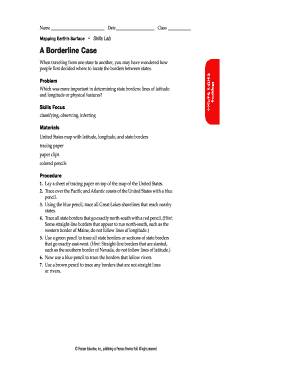
  2. Fill in your name, date, and class in the designated fields at the top of the form. Ensure that the information is accurate as this identifies your work throughout the lab exercise.
  3. Proceed with the procedure section by following the instructions closely. Use tracing paper as directed to outline the Pacific and Atlantic coasts with a blue pencil, and ensure to follow the rest of the tracing steps using the specified colors for different features.
  4. In the analyze and conclude section, provide detailed answers in the spaces provided. Remember to focus on the importance of physical features and their relation to state borders. Utilize your observations to respond accurately.
  5. Review your responses to ensure clarity and completeness. Check that all sections are filled out accurately, reflecting your understanding of the material.
  6. Once you have completed the form, save your changes, download a copy for your records, or print the form if needed. You may also share it as required.

Complete your digital documents online today to enhance your learning experience!

Get form

Experience a faster way to fill out and sign forms on the web. Access the most extensive library of templates available.
Get form

Related content

EARTH MANUAL - Bureau of Reclamation
by T EDITION — Agricultural Soil Maps . ... level surface, and from (B) cutbank or side...
Learn more
Games and Simulations | UCAR Center for Science...
Explore the atmosphere by launching Virtual Weather Balloons! This "virtual laboratory"...
Learn more
Civil engineering - Wikipedia
Civil engineering is a professional engineering discipline that deals with the design...
Learn more

Related links form

Procurement Desktop - : Simplified Purchase - DTMA1V09270 - Atletic Supplies. Instructions For Form PRSAR070131 See Line Item Detail And Shipping Detail B Or Reorganization Of Zones And Can - Gpo Complaint And In This Notice May Be - Gpo

Questions & Answers

Get answers to your most pressing questions about US Legal Forms API.

Contact support

What are the ways to represent the Earth's surface? In Geography, different forms of representation of the Earth's surface are used, such as: the globe, maps, planispheres, planetarium, imaginary lines, signs, symbols, etc.

Topographic map. a map that shows the surface features of an area, shows surface features of an area such as mountains, valleys, plains, and plateaus by using contour lines to show changes in elevation; also known as a contour map.

Imagery Maps: Precise images using sensors and cameras can be gathered by highflying aircraft and satellites orbiting Earth. Computer models translate the data into images and scientists can identify features on the Earth‟s surface through colors and shapes that features make on the image.

A map projection is a certain way of transferring the curved surface of the Earth to a flat map. Mapmakers use map projections to move the image of the Earth's curved surface onto a flat map. To understand how map projections are made, think of a clear globe with a light inside it.

Get This Form Now!

Use professional pre-built templates to fill in and sign documents online faster. Get access to thousands of forms.
Get form
If you believe that this page should be taken down, please follow our DMCA take down processhere.

Industry-leading security and compliance

US Legal Forms protects your data by complying with industry-specific security standards.
  • In businnes since 1997
    25+ years providing professional legal documents.
  • Accredited business
    Guarantees that a business meets BBB accreditation standards in the US and Canada.
  • Secured by Braintree
    Validated Level 1 PCI DSS compliant payment gateway that accepts most major credit and debit card brands from across the globe.
Get Mapping Earths Surface Skills Lab A Borderline Case
Get form
Form Packages
Adoption
Bankruptcy
Contractors
Divorce
Home Sales
Employment
Identity Theft
Incorporation
Landlord Tenant
Living Trust
Name Change
Personal Planning
Small Business
Wills & Estates
Packages A-Z
Form Categories
Affidavits
Bankruptcy
Bill of Sale
Corporate - LLC
Divorce
Employment
Identity Theft
Internet Technology
Landlord Tenant
Living Wills
Name Change
Power of Attorney
Real Estate
Small Estates
Wills
All Forms
Forms A-Z
Form Library
Customer Service
Terms of Service
Privacy Notice
Legal Hub
Content Takedown Policy
Bug Bounty Program
About Us
Help Portal
Legal Resources
Blog
Affiliates
Contact Us
Delete My Account
Site Map
Industries
Forms in Spanish
Localized Forms
State-specific Forms
Forms Kit
Legal Guides
Real Estate Handbook
All Guides
Prepared for You
Notarize
Incorporation services
Our Customers
For Consumers
For Small Business
For Attorneys
Our Sites
US Legal Forms
USLegal
FormsPass
pdfFiller
signNow
airSlate WorkFlow
DocHub
Instapage
Social Media
Call us now toll free:
+1 833 426 79 33
As seen in:
  • USA Today logo picture
  • CBC News logo picture
  • LA Times logo picture
  • The Washington Post logo picture
  • AP logo picture
  • Forbes logo picture
© Copyright 1997-2025
airSlate Legal Forms, Inc.
3720 Flowood Dr, Flowood, Mississippi 39232