We use cookies to improve security, personalize the user experience, enhance our marketing activities (including cooperating with our marketing partners) and for other business use.
Click "here" to read our Cookie Policy. By clicking "Accept" you agree to the use of cookies. Read less
Read more
Accept
Loading
Form preview
  • US Legal Forms
  • Form Library
  • More Forms
  • More Uncategorized Forms
  • Usgs Geospatial Liaison Guide To The Gpsc - Thor-f5 Er Usgs

Get Usgs Geospatial Liaison Guide To The Gpsc - Thor-f5 Er Usgs

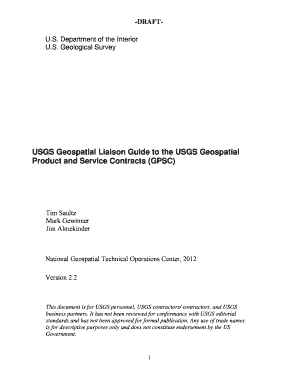
DRAFTU.S. Department of the Interior U.S. Geological Survey USGS Geospatial Liaison Guide to the USGS Geospatial Product and Service Contracts (GPSC) Tim Saultz Mark Gewinner Jim Almekinder National.

How it works

  1. Open form

    Open form follow the instructions

  2. Easily sign form

    Easily sign the form with your finger

  3. Share form

    Send filled & signed form or save

How to fill out the USGS Geospatial Liaison Guide To The GPSC - Thor-f5 Er Usgs online

Filling out the USGS Geospatial Liaison Guide To The GPSC - Thor-f5 Er Usgs correctly is essential for effective project management. This guide provides step-by-step instructions to ensure users complete the form accurately and efficiently.

Follow the steps to successfully complete the form.

  1. Press the ‘Get Form’ button to access the USGS Geospatial Liaison Guide.
  2. Begin by reading the introduction section of the form to understand its purpose and key components.
  3. Fill in your personal and organization details in the designated fields accurately to establish your identity.
  4. Elaborate on the project concept using the Project Planning requirements if applicable, ensuring specifications reflect customer needs.
  5. Develop the Statement of Work (SOW) by describing the specific services and deliverables required, ensuring clarity on responsibilities.
  6. Attach any required financial documentation, such as Independent Government Cost Estimates (IGCE), to the SOW.
  7. Submit the complete SOW for review to ensure it meets all guidelines and expectations outlined in the manual.
  8. After receiving approval, finalize and save your document, ensuring you check that all data is entered correctly before submitting.
  9. You can download, print, or share the form as necessary for further processing.

Start filling out your USGS Geospatial Liaison Guide To The GPSC - Thor-f5 Er Usgs online now to ensure a smooth project execution.

Get form

Experience a faster way to fill out and sign forms on the web. Access the most extensive library of templates available.
Get form

Related content

Legal Approaches for Open Access to Research Data
http://pubs.usgs.gov/of/2011/1057/pdf/of2011-1057.pdf; and government use of data from the...
Learn more

Related links form

SPIRIT 2013 Checklist: Recommended Items To Address In A Clinical Trial Protocol And Fp 524 Minnesota Statutes 2016, Section 582.041 - Revisor Mn Abaxis Cdp Cbc

Questions & Answers

Get answers to your most pressing questions about US Legal Forms API.

Contact support

If you are looking for a particular data set and cannot find it through Internet searches or our Science Data Catalog, please call USGS Science Information Services toll-free at 1-888-392-8545 or use this website to send us a message or to initiate a live Web chat with a Science Information Specialist.

The best known USGS maps are those of the 7.5-minute, 1:24,000-scale quadrangle series.

As one of the cornerstones of the U.S. Geological Survey's (USGS) National Geospatial Program, The National Map is a collaborative effort among the USGS and other Federal, State, and local partners to improve and deliver topographic information for the Nation.

In simple terms, geospatial information is geography and mapping. It is “place based” or “locational” information. It is data tied to and portrayed on a map.

A Geographic Information System (GIS) is a computer system that analyzes and displays geographically referenced information. It uses data that is attached to a unique location.

USGS Staged Data - Direct links to files on a USGS server. Navigate to the appropriate theme folders to access staged products for download. Download Manager Tool/uGET – For batch downloads of files using URLs saved in a text or CSV file from The National Map Downloader. TopoView – For topographic map downloads only.

USGS.gov. Science for a changing world. A .gov website belongs to an official government organization in the United States.

Some of the most common types of GIS maps are: category, heat, cluster, bubble, and quantity ones. Category Maps. ... Heat Maps. ... Cluster Maps. ... Bubble Maps. ... Quantity Maps. ... Map Queries. ... AOI-Specific Information. ... Measuring And Distance Tools.

Get This Form Now!

Use professional pre-built templates to fill in and sign documents online faster. Get access to thousands of forms.
Get form
If you believe that this page should be taken down, please follow our DMCA take down processhere.

Industry-leading security and compliance

US Legal Forms protects your data by complying with industry-specific security standards.
  • In businnes since 1997
    25+ years providing professional legal documents.
  • Accredited business
    Guarantees that a business meets BBB accreditation standards in the US and Canada.
  • Secured by Braintree
    Validated Level 1 PCI DSS compliant payment gateway that accepts most major credit and debit card brands from across the globe.
Get USGS Geospatial Liaison Guide To The GPSC - Thor-f5 Er Usgs
Get form
Form Packages
Adoption
Bankruptcy
Contractors
Divorce
Home Sales
Employment
Identity Theft
Incorporation
Landlord Tenant
Living Trust
Name Change
Personal Planning
Small Business
Wills & Estates
Packages A-Z
Form Categories
Affidavits
Bankruptcy
Bill of Sale
Corporate - LLC
Divorce
Employment
Identity Theft
Internet Technology
Landlord Tenant
Living Wills
Name Change
Power of Attorney
Real Estate
Small Estates
Wills
All Forms
Forms A-Z
Form Library
Customer Service
Terms of Service
Privacy Notice
Legal Hub
Content Takedown Policy
Bug Bounty Program
About Us
Blog
Affiliates
Contact Us
Delete My Account
Site Map
Industries
Forms in Spanish
Localized Forms
State-specific Forms
Forms Kit
Legal Guides
Real Estate Handbook
All Guides
Prepared for You
Notarize
Incorporation services
Our Customers
For Consumers
For Small Business
For Attorneys
Our Sites
US Legal Forms
USLegal
FormsPass
pdfFiller
signNow
airSlate WorkFlow
DocHub
Instapage
Social Media
Call us now toll free:
+1 833 426 79 33
As seen in:
  • USA Today logo picture
  • CBC News logo picture
  • LA Times logo picture
  • The Washington Post logo picture
  • AP logo picture
  • Forbes logo picture
© Copyright 1997-2025
airSlate Legal Forms, Inc.
3720 Flowood Dr, Flowood, Mississippi 39232