Loading
Get Gis Worksheet
How it works
-

Open form follow the instructions
-

Easily sign the form with your finger
-

Send filled & signed form or save
How to fill out the Gis Worksheet online
The Gis Worksheet is a valuable tool for documenting watershed information and understanding hydrologic units. This guide provides clear, step-by-step instructions to help you fill out the worksheet online, ensuring that you accurately complete each section.
Follow the steps to effectively fill out the Gis Worksheet.
- Click the ‘Get Form’ button to access the Gis Worksheet and open it in your preferred editor.
- Begin by entering your name, date, and period in the designated fields at the top of the worksheet.
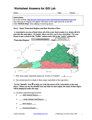
- Navigate to Part I: Major Watershed Regions. Use the provided online GIS map. For each major watershed region shown, check the 'Visible' column and mark the 'Active' column as needed.
- Proceed to check the 'Visible' column for 'Bordering States' to identify and write the states surrounding Virginia.
- Detail your current county and specify in which major watershed it is located. Make sure to identify where the water in your watershed flows.
- For Part II: Hydrologic Units, you will fill in a table. Use the zoom feature to explore different levels of classification, making sure to note the unit numbers, levels, and names.
- In Part III, identify and trace the divide on the map as specified between the two watersheds described.
- For Part IV about tributaries, check the appropriate boxes for visibility and activity. Use the Identify icon to locate and label the tributaries of the James River.
- Complete Part V by exploring point source and nonpoint source pollution. Answer the explanation question regarding water quality concerns using your observations from the map.
- Once all sections are completed, save your changes. You may download, print, or share the Gis Worksheet as necessary.
Start filling out your Gis Worksheet online today to enhance your understanding of watershed management.
A geographic information system (GIS) is a system that creates, manages, analyzes, and maps all types of data. GIS connects data to a map, integrating location data (where things are) with all types of descriptive information (what things are like there).
Industry-leading security and compliance
US Legal Forms protects your data by complying with industry-specific security standards.
-
In businnes since 199725+ years providing professional legal documents.
-
Accredited businessGuarantees that a business meets BBB accreditation standards in the US and Canada.
-
Secured by BraintreeValidated Level 1 PCI DSS compliant payment gateway that accepts most major credit and debit card brands from across the globe.