Get Fema Riverine Hydrology And Hydraulic From
How it works
-

Open form follow the instructions
-

Easily sign the form with your finger
-

Send filled & signed form or save
How to fill out the Fema Riverine Hydrology And Hydraulic Form online
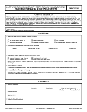
The Fema Riverine Hydrology And Hydraulic Form is an essential document for analyzing flood conditions in riverine environments. This guide provides a clear, step-by-step process for users to complete the form efficiently and accurately in an online format.
Follow the steps to complete the form successfully.
- Click ‘Get Form’ button to acquire the form and open it in an appropriate online editing tool.
- In section A: Hydrology, begin by checking the reason for the new hydrologic analysis. Select all applicable options such as 'No existing analysis' or 'Changed physical condition of watershed'.
- Next, provide the comparison of representative 1%-annual-chance discharges by entering the location and drainage area in square miles. Fill in the effective and revised discharge values in cubic feet per second (cfs).
- For the methodology of the new hydrologic analysis, check all applicable methods used, including options like 'Statistical Analysis of Gage Records' and 'Precipitation/Runoff Model'.
- If required, attach any approval or review evidence from regional, state, or federal agencies regarding your hydrologic analysis.
- Indicate whether sediment transport was considered in your analysis, and if applicable, fill out section F of Form 3. If not, provide an explanation.
- Proceed to section B: Hydraulics, where you will describe the reach to be revised and input water-surface elevations at effective and proposed/revised conditions.
- Specify the hydraulic method or model used, and submit any pre-submittal review of hydraulic models as needed using tools like CHECK-2 and CHECK-RAS.
- In section C: Mapping Requirements, submit a certified topographic map and digital mapping data that includes relevant floodplain boundaries.
- For section D: Common Regulatory Requirements, answer questions regarding Base Flood Elevations, placement of fill, and potential impacts on endangered species, attaching necessary documentation.
- After completing all sections, review your entries for accuracy, then save changes, download, print, or share the form as needed.
Complete your documents online today to ensure compliance and accuracy in your riverine hydrology and hydraulic analysis.
The maximum payout for a standard flood insurance policy under the NFIP is $250,000 for residential buildings and $100,000 for personal property. This limit may vary for commercial properties and additional policies. Being aware of these limits is vital when planning for flood risk, especially as they relate to Fema Riverine Hydrology And Hydraulic From evaluations. Consider using resources like USLegalForms for assistance with flood insurance documentation.
Industry-leading security and compliance
-
In businnes since 199725+ years providing professional legal documents.
-
Accredited businessGuarantees that a business meets BBB accreditation standards in the US and Canada.
-
Secured by BraintreeValidated Level 1 PCI DSS compliant payment gateway that accepts most major credit and debit card brands from across the globe.